In the spring of 1896 two men squeezed into a small, dark room deep inside the ruins of Pueblo Bonito, in a canyon in north-western New Mexico that almost nobody visited. The room had been sealed for the better part of a thousand years. On its floor they found the dead (fourteen people in the end), and around them the richest burial ever dug in the American Southwest: tens of thousands of turquoise beads and pendants, whole conch shells from a warm sea hundreds of miles away, a wooden staff, and jars that had once held things brought from far to the south. The men, George Pepper and Richard Wetherill, had no idea whose bodies these were. That question would take another hundred and twenty-nine years to answer, and the answer would come not from an archaeologist but from a living community that had been saying it all along.
The canyon is called Chaco. It is one of the strangest places in North America, and for a long time it was one of the most misread. Stand in it today and you see low sandstone cliffs, a dry wash, sagebrush, and a sky that goes on without interruption. It is hot in summer, bitter in winter, and there is not enough water. Nothing about it says capital city. And yet a thousand years ago people raised here the largest buildings anyone would put up in North America until the nineteenth century, roofed them with a quarter of a million trees dragged in from mountains you cannot even see from the canyon floor, and ran dead-straight roads out across the desert from them. Then they left. For a century the ruins were explained by everything except the obvious truth about who had made them.
A canyon that should have been empty
Chaco sits in the San Juan Basin, a high, wind-scoured bowl of land in the Four Corners country where New Mexico, Arizona, Colorado and Utah meet. It is desert in the honest sense. The growing season is short, the winters drop well below freezing, and rainfall is both meagre and unreliable: a wet year and a killing drought can sit only a decade apart. To farm maize here at all is to gamble every season against the sky.
This is the ground on which, from about the middle of the ninth century, people began to build on a scale that had no precedent north of Mexico. Over roughly three hundred years they put up more than a dozen enormous masonry buildings along a ten-mile stretch of the canyon, and dozens more (the “outliers”) scattered across tens of thousands of square miles of the basin beyond. The buildings in the canyon were not villages that had grown room by room. They were planned. Someone laid them out whole, on the ground, before the first stone went down, and then generations built to the plan.
The people who did this are known, a little awkwardly, as the Ancestral Puebloans: the ancestors of the Pueblo peoples who live in New Mexico and Arizona today, at Acoma and Zuni and Hopi and the villages along the Rio Grande. An older name, Anasazi, is a Navajo word that Pueblo people dislike, and it is falling out of use for good reason. These were not a vanished race. They were somebody’s grandparents, and it matters to keep saying so, because for most of a century the story was told as though they were a mystery with no living heirs.
What a “great house” really was
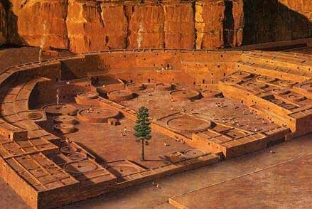
The buildings are called great houses, which undersells them. Pueblo Bonito, the largest and most studied, was a single connected structure that grew to hold something in the region of six hundred and fifty rooms. It rose four and, in places, five storeys at the back, stepping down towards a great walled plaza like the inside of a stadium. Its ground plan is a rough D: a long straight wall closing off a curved sweep of terraced rooms. From the air it looks less like a house than like a piece of civic architecture, which is what it was.
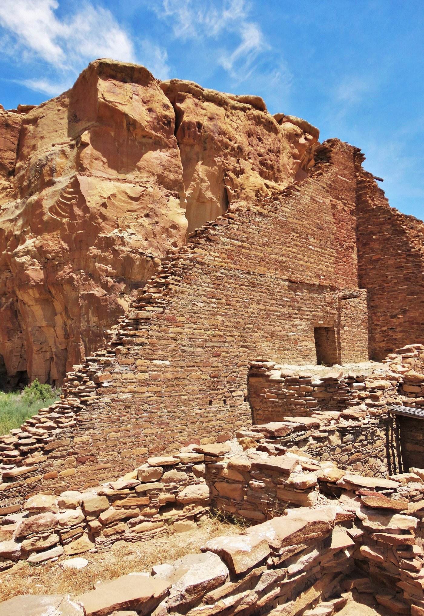
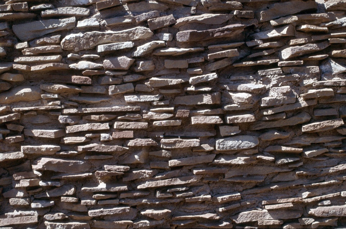
To hold up walls that tall, Chacoan builders used a technique you can still read in the stone. The core of each wall is rubble and mud mortar; the two faces are a veneer of thin sandstone tablets, shaped and fitted into patterns, sometimes banded, sometimes almost a mosaic. The veneer is beautiful, and, strangely, much of it was then covered with plaster and never seen again. The masons took great care over surfaces they meant to hide. They built as if the building itself were owed the workmanship, whether or not a human eye would ever get the benefit.
Around six hundred and fifty rooms under one roof. Four to five storeys at the tallest. Some two dozen kivas (round ceremonial chambers) set into its plazas and room blocks, including two of the great sunken kind. Building went on in bursts across roughly three centuries, from about 850 to the middle of the 1100s. When it was finished it was the largest building in North America, and it would keep that title until a bigger one went up in the United States in the 1800s. It was raised without the wheel, without draft animals, and without a single metal tool.
The problem of the timber
Now the roofs. A great house of stone still needs wood to span it: main beams to carry the floors and ceilings, and above them a dense layer of smaller poles. Chaco’s builders used enormous quantities of timber: straight trunks of ponderosa pine, and higher-altitude spruce and fir, the kind of trees that do not grow in a hot, dry canyon and never did. Add up the beams across all the great houses and the total comes to something like two hundred and forty thousand trees, felled and moved over the three centuries of building.
Every one of them was carried in on foot. There were no wheeled carts in the pre-Columbian Southwest and no oxen or horses to pull them; the horse would not arrive until the Spanish brought it, centuries later. So a beam was felled with a stone axe (not cut so much as bruised through, blow after blow, until the trunk could be tipped), then stripped, trimmed, seasoned, and hauled by teams of people across fifty miles or more of open country to the canyon. A single main beam could be five metres long and weigh as much as three grown adults. They moved a quarter of a million of them this way, and they did it carefully: the beams show almost no drag marks, which means they were lifted and carried, not dragged, most likely on wooden litters shouldered by crews.
For decades no one could say where the wood had come from, only that it was not local. The answer came from chemistry. Trees take up strontium from the soil they grow in, and the balance of strontium isotopes differs from one mountain range to another, leaving a kind of geological fingerprint locked in the wood. When researchers matched the fingerprints in Chaco’s preserved beams against the ranges around the basin, two sources stood out: the Chuska Mountains, some seventy-five kilometres to the west, and the San Mateo Mountains to the south. Later work on tree rings pinned it down further, even showing the sources shifting over time as one forest was worked and then another. The beams had, in effect, been carrying their own address all along.
Lined up with the sun and the moon
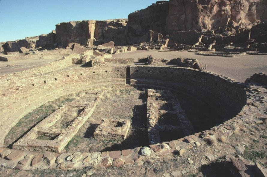
Set into the plazas of the great houses are the kivas: round rooms, dug down into the earth, reached by a ladder through the roof. Small ones served households and clans. The great kivas were something else: ceremonial chambers up to nineteen metres across, ringed with stone benches, floored with paired masonry vaults, roofed with timbers so heavy that the columns holding them up sat on stacked stone discs to spread the load. Casa Rinconada, across the wash from Pueblo Bonito, is a free-standing great kiva that could hold a crowd. To step down into one was to step out of the ordinary world.
What lifts Chaco out of the ordinary, though, is that the buildings were talking to the sky. Several great houses are aligned with real precision to the cardinal directions or to the movements of the sun and moon. One long wall of Pueblo Bonito runs almost exactly north–south; another tracks the sunrise and sunset at the solstices. More remarkable still, some buildings are set to the moon: not to its monthly path but to the far slower swing of its rising point over an eighteen-and-a-half-year cycle, the lunar standstill, which you can only work out by watching the horizon patiently for a generation and writing nothing down.
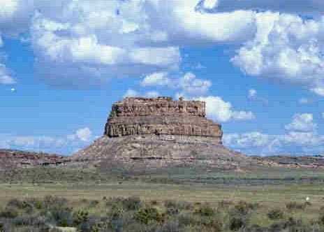
The most famous single instrument sits high on Fajada Butte, the steep-sided tower of rock that rises from the canyon floor. There, three leaning slabs of stone cast blades of sunlight onto a spiral carved into the cliff behind them. At the summer solstice a single dagger of light splits the centre of the spiral; at the equinoxes and the winter solstice, the daggers fall in other, deliberate places. It is a calendar written in shadow, and it was noticed by chance only in 1977. Whoever made it understood the year with a precision that took modern observers years to be sure of.
The roads that ignored the map
Then there are the roads. From the great houses, wide tracks run out across the desert: not footpaths worn by traffic but constructed roads, up to nine metres across, their edges lined with stone or low earthen banks, their surfaces cleared and levelled. More than a hundred and eighty miles of them have been traced, and there are almost certainly more, visible now mainly from the air as faint straight lines that the low sun picks out.
What makes them uncanny is how they behave. A sensible road bends to find the easy grade. Chaco’s roads do the opposite. They run dead straight for miles, and where a cliff gets in the way they do not go around it. They climb it, by stairways and ramps cut into the rock, and carry on in the same line on the far side. The Great North Road is the clearest case: it strikes almost due north from the canyon for some thirty-five miles, holding its bearing to within a fraction of a degree, and then simply ends, near a badlands canyon, at no town and no obvious destination at all.
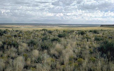
If the point were moving goods and people, the roads make little sense: they are far wider than foot traffic needs, they run in parallel sets where one track would do, and some of the grandest lead nowhere useful. Many archaeologists now read them as more ceremony than commerce: processional ways, lines drawn on the land to tie outlying communities to the centre, or to the directions themselves. The Great North Road may point less to a place than to an idea of north, and to the world Pueblo tradition holds lies in that direction. Others keep a foot in the practical camp: even a ritual road can carry a pilgrim, and a straight line is the plainest way to say this belongs to Chaco. What is not in doubt is that building them took enormous, organised effort for reasons that were not simply about getting from one place to another.
Macaws, chocolate and copper bells
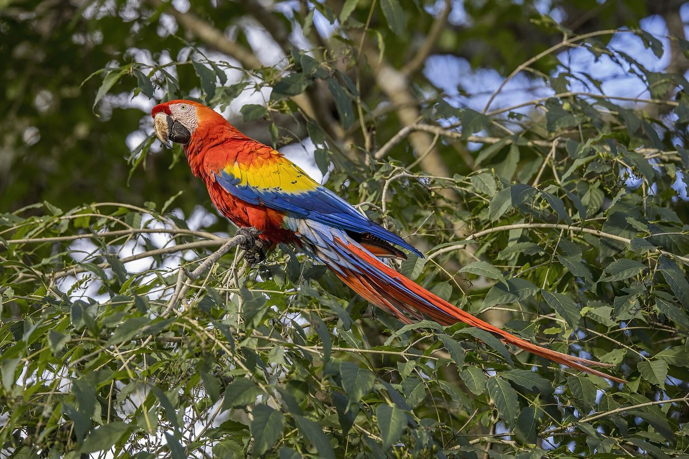
For a place this remote, Chaco was startlingly well connected. In its rooms and burials excavators have found things that have no business in a high desert: shells from the Gulf of California and the Pacific coast, small copper bells cast in western Mexico, and the bones and feathers of scarlet macaws, tropical birds whose natural range begins more than a thousand miles to the south, in the lowland forests of Mexico and beyond. The macaws were not passing through. Some were kept alive at Chaco and bred there; they arrived as living birds, carried north hand to hand across deserts and mountains, prized enough to justify the journey.
Stranger still is what some of Chaco’s pottery once held. Among the finds are tall, straight-sided cylinder jars, a shape almost unknown elsewhere in the Southwest but familiar from the Maya world, where such vessels were used for drinking chocolate. When chemists tested the residue inside Chaco’s jars, they found the marker for cacao, a plant that will not grow anywhere near New Mexico and had to come from Mesoamerica. People in this canyon were drinking chocolate out of Maya-style cups, a thousand miles and a world away from where either the cups or the drink began. In the other direction went turquoise, worked at Chaco and traded south, where it was treasured. The canyon was a hinge in a network that reached to two coasts and across an international border that did not yet exist.
The mystery that never needed solving
Here is where the story of Chaco went wrong for a long time. Faced with monumental ruins in a place that seemed too poor to have built them, and with living Pueblo people whom outsiders were unwilling to credit, nineteenth-century observers reached for a vanished race: some lost, superior people who had raised the great houses and then disappeared, leaving no descendants. It is the same reflex that met Great Zimbabwe in Africa and the mounds of the American Midwest: the assumption that the impressive thing in front of you cannot have been made by the people whose ancestors actually made it.
Chaco was built by a mysterious vanished civilisation who then disappeared without a trace, leaving ruins that the region’s later inhabitants had nothing to do with. The great houses stand empty because their true makers are gone from the earth.
The builders of Chaco did not vanish. They were Ancestral Pueblo people, and when the canyon emptied they moved: north to places like the Aztec great houses, and in time out to the Hopi mesas, to Zuni, to Acoma, and to the pueblos of the Rio Grande, where their descendants live now. Pueblo oral histories have always spoken of Chaco as part of that story, a place their ancestors passed through and left on purpose. The mystery was never really who built it. The mystery was why anyone found it so hard to believe the answer.
A line of mothers
Which brings us back to the sealed room where this began. The burials in Room 33 of Pueblo Bonito were the richest ever found in the Southwest, and the two oldest men in the crypt lay beneath the greatest concentration of turquoise ever recovered from a single North American context. These were plainly important people, buried at the founding of the great house and honoured for generations after; the room stayed in use, as a kind of ancestral shrine, for centuries.
In 2017 a team led by the archaeologist Douglas Kennett read the DNA that Pepper and Wetherill could never have imagined. Nine of the individuals in Room 33 shared exactly the same mitochondrial DNA, the kind passed only from a mother to her children. They belonged, in other words, to a single family line traced through its women, and the burials in that line spanned roughly three hundred and thirty years, from about 800 to 1130. Nuclear DNA tied some of them together directly: a mother and her daughter, a grandmother and her grandson. It is the clearest evidence anywhere in the ancient Southwest of a ruling family, and at Chaco, in a society without kings on paper, power seems to have run down the female line.
The century the rain failed
Nothing built on farming this marginal could outlast a long enough drought, and in the middle of the twelfth century one came. From about 1130, the tree rings record decades of failed rains across the San Juan Basin, the kind of drought that empties granaries and breaks the promises a centre makes to the people who feed it. Chaco had also spent three centuries eating its own surroundings: the timber gone for fifty miles around, the land worn and eroded. When the rain stopped, there was little slack left to take up.
Building in the canyon slowed and then stopped. People drifted away, many of them north to the Totah country around the modern town of Aztec, where a great house had already been raised in the Chacoan style, as if to carry the centre with them. That effort, too, eventually gave out. By the 1300s the great houses of Chaco stood silent, their rooms bricked up, their beams left in place, their kivas open to the sky. It reads like an ending. It was really a migration: a long dispersal that seeded the villages the Spanish would later find lived-in and busy along the Rio Grande and out on the western mesas.
“We have always been here”
In April 2025 the last piece fell into place, and it did not come from a university reaching in. It came from a Pueblo reaching back. Picuris Pueblo, a small community in the mountains of northern New Mexico, had grown tired of being told its history by outsiders and of watching that history get it wrong. So the tribe did something new: it commissioned the science itself, chose the questions, and led the study of its own past.
Working with geneticists on the tribe’s own terms, the project compared DNA from Picuris ancestors who had lived between about 1300 and 1500 with DNA from living members of the community, and set both against the ancient people of Pueblo Bonito, some two hundred and seventy-five kilometres to the west. The living Picuris are the direct descendants of their own ancestors, and both carry a maternal genetic thread that runs back to Chaco Canyon. The result was published in Nature, the first genomic study of an ancestral population led and co-authored by the federally recognised tribe it concerned.
What the DNA said, the community had been saying all along. “Our elders knew we had always been here,” the pueblo’s lieutenant governor, Craig Quanchello, put it, “but it was very moving and powerful to see it validated on paper that we have a maternal genetic link to Chaco Canyon.” The oral history and the laboratory had arrived at the same place. One had simply taken a great deal longer, and a great deal of persuading, to get there.
Go back to Room 33 with that in mind and the sealed crypt reads differently. Pepper and Wetherill, crawling into the dark in 1896, thought they had found a mystery: unknown people, an unknown city, a lost world. What they had actually found was a family: a line of mothers and their children, honoured at the heart of a city their descendants never forgot. The great houses were never the ruins of a vanished race. They are the empty rooms of people who packed up, moved on, and are still, a thousand years later, entirely able to tell you who they are.
Read next: Cahokia: The Mound City That Emptied Itself.
Sources & further reading
- Thomas C. Windes, George H. Pepper and the excavation of Pueblo Bonito’s Room 33 — National Park Service and Chaco Culture NHP research summaries.
- Douglas J. Kennett et al., “Archaeogenomic evidence reveals prehistoric matrilineal dynasty,” Nature Communications (2017).
- Thomas W. Swetnam, Christopher Guiterman et al., “Beam sourcing at Chaco Canyon,” work on strontium isotopes and tree rings, PNAS and related papers (2015–2016).
- Patricia L. Crown and W. Jeffrey Hurst, “Evidence of cacao use in the Prehispanic American Southwest,” PNAS (2009).
- Thomas C. Windes and colleagues on the early procurement of scarlet macaws, PNAS (2015).
- Thomaz Pinotti, Craig Quanchello et al., “Picuris Pueblo oral history and genomics reveal continuity in the US Southwest,” Nature (2025).
- Stephen H. Lekson, The Chaco Meridian and A History of the Ancient Southwest.
Image credits (via Wikimedia Commons): Pueblo Bonito from the canyon rim — Rationalobserver (CC BY-SA 4.0); digital reconstruction of Pueblo Bonito — NASA feature illustration (public domain); core-and-veneer masonry — Gerd Eichmann (CC BY-SA 4.0); a great kiva at Pueblo Bonito — National Park Service (public domain); Fajada Butte — Khlnmusa (CC BY-SA 3.0); scarlet macaw — Charles J. Sharp (CC BY-SA 4.0); a Chacoan road from the air — NASA / Marshall Space Flight Center (public domain).