In 1923 a Cornish geologist named Herbert Henry Thomas published a short paper in The Antiquaries Journal and blew a very old argument wide open. Thomas had spent months chipping fragments off some of Stonehenge's smaller uprights, comparing them under a microscope with rock samples he had collected far to the west, in a low range of hills at the far tip of Wales. The match, he wrote, was unmistakable. The bluestones at Stonehenge, those inner uprights of dark, mottled rock that had puzzled antiquarians for centuries, had come from Pembrokeshire, roughly two hundred and forty kilometres away. Thomas thought Neolithic people had dragged them the entire distance by hand and by boat. Almost as soon as the ink was dry, other scientists started saying he was wrong: it was the glaciers, they said, that had done the heavy lifting, and human beings had merely picked up what the ice had dumped on their doorstep. That argument would run for the next hundred and three years. It was finally settled, more or less, on 21 January 2026, in a lab in Perth, Western Australia, by five hundred grains of an almost indestructible mineral called zircon.
The wrong stones in the right place
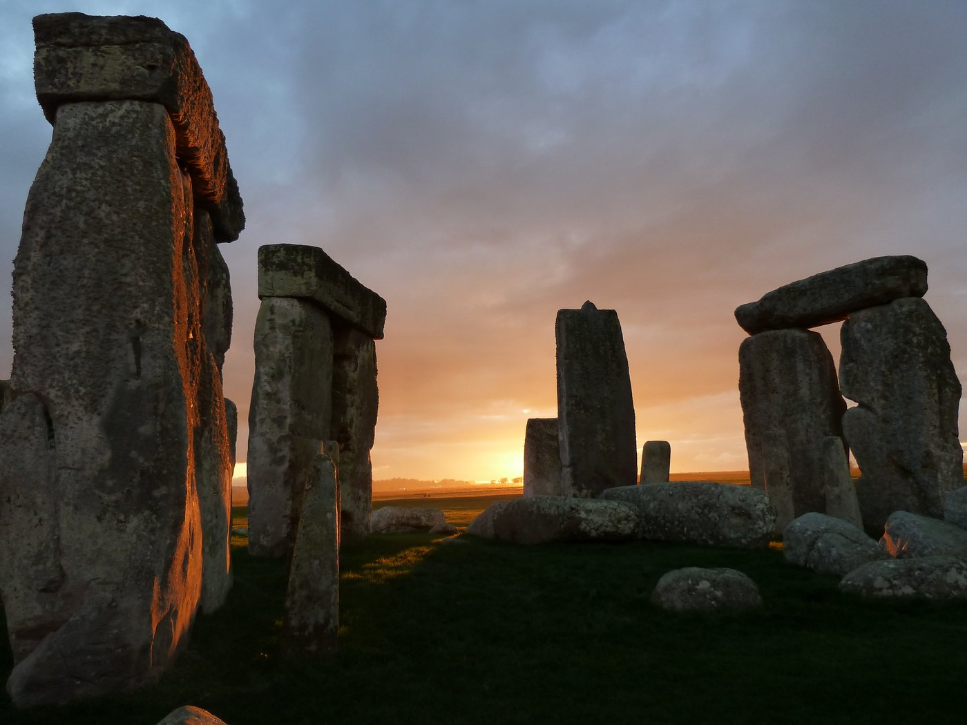
Most people who visit Stonehenge look at the wrong rocks. The famous silhouette (the massive uprights with their capping lintels, the horseshoe of trilithons at the centre) is almost entirely made of a local sandstone called sarsen, quarried around twenty-five kilometres away from the site at a place called West Woods and dragged across the downs. Sarsen is a good, honest Wiltshire stone. Nobody has ever really argued about where it came from. It is the smaller, darker uprights, standing in an inner ring and a horseshoe inside the sarsens, that made Stonehenge one of the strangest engineering problems in prehistory. These are the bluestones.
There are forty-three of them still on the site, out of an original setting that probably held around eighty. Most weigh between two and five tonnes, which is small compared with the thirty-tonne sarsens but not small in any meaningful sense: a five-tonne block is the weight of a fully grown African elephant. They are not one kind of rock but several: mostly a spotted dolerite, an igneous stone whose surface is flecked with pale patches of feldspar; but also rhyolites, tuffs and volcanic ashes, and a single conspicuous slab of grey-green sandstone lying flat at the heart of the monument that generations of visitors have called the Altar Stone. All of them are geological strangers on Salisbury Plain. Nothing like them outcrops anywhere within a hundred kilometres of Stonehenge.
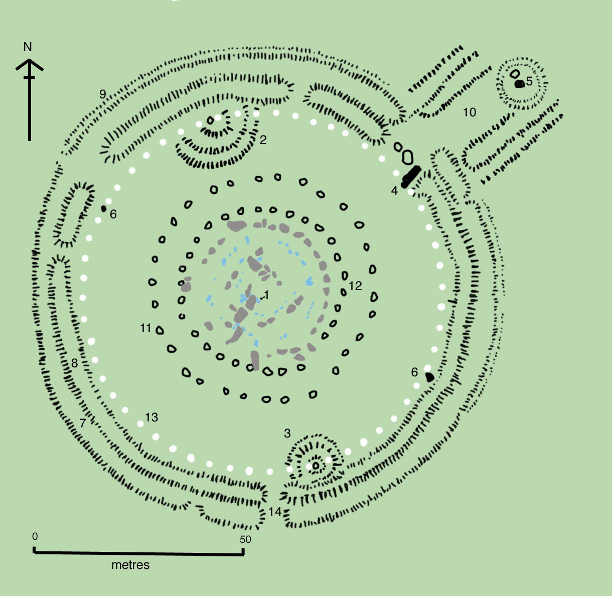
That fact was known long before Thomas. Antiquarians as far back as the seventeenth century had noticed that the bluestones did not belong; the folklorist Geoffrey of Monmouth, writing around 1136, cheerfully claimed that Merlin the wizard had magicked the whole monument over from Ireland. Merlin at least had the right general direction. What nobody could pin down, until Thomas took his hammer to it, was exactly where the stones came from and how they had got to Salisbury Plain.
The Cornishman with a microscope
Herbert Thomas worked for the Geological Survey and had spent a career learning to read the fine-grained differences between one bit of hard rock and another. His breakthrough was less dramatic than it sounds. He simply had access to two things earlier antiquarians had not: a large comparative collection of rock samples from all over Britain, and a petrographic microscope powerful enough to show him the crystal structure of what he was looking at. He worked through the bluestones fragment by fragment, matched them against his reference collection, and kept arriving at the same corner of the map: the Preseli Hills, a low, treeless ridge that runs east to west across the north of Pembrokeshire in the far south-western tip of Wales.
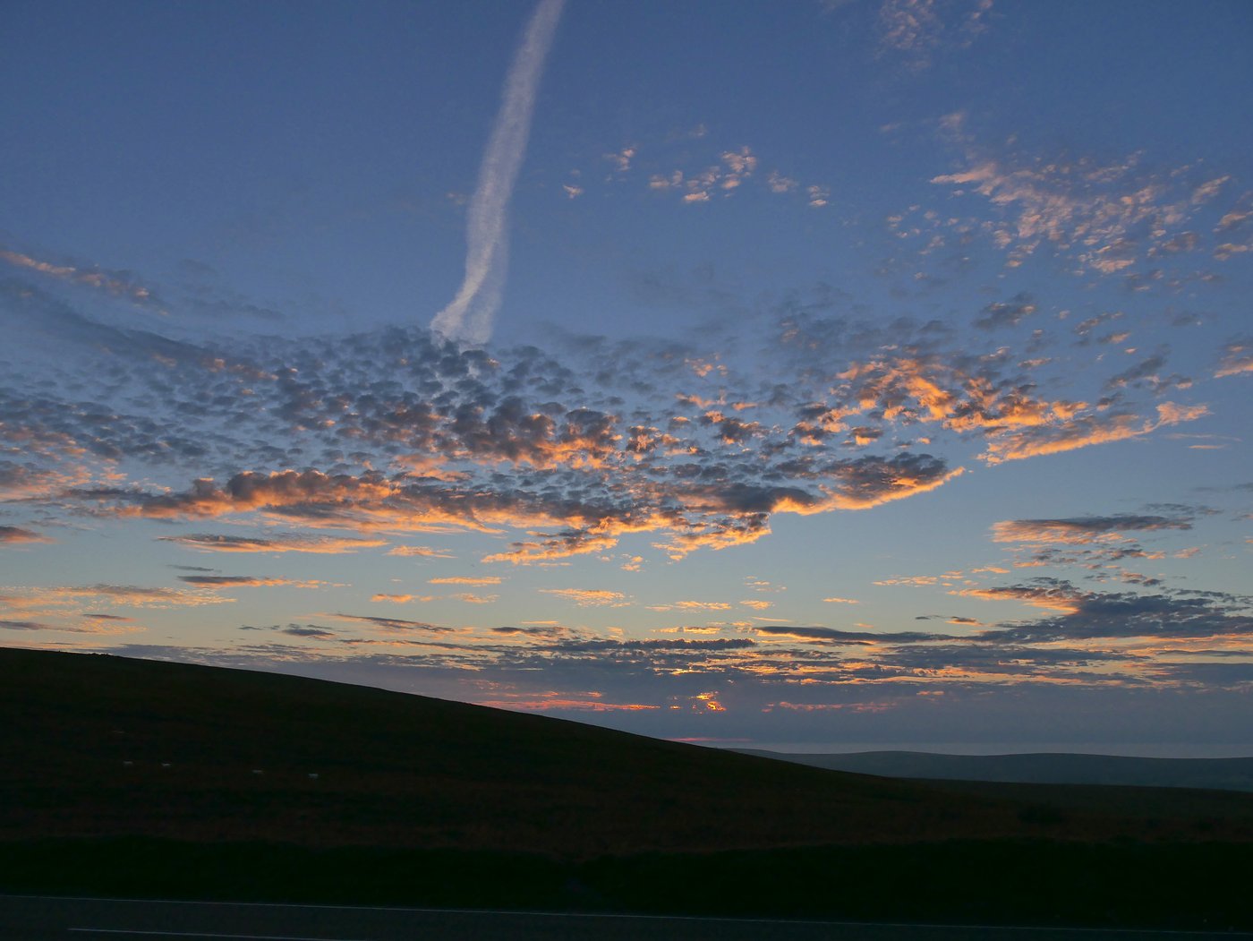
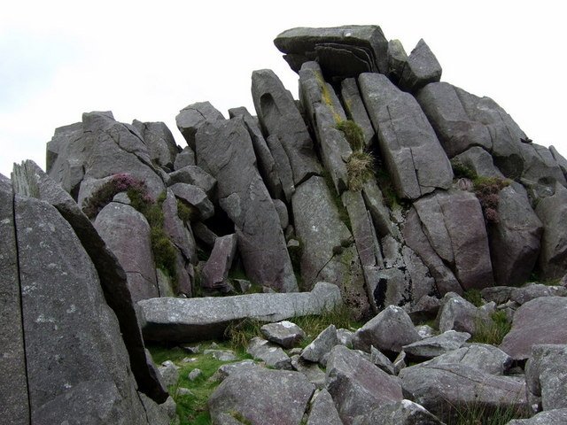
Nothing about Preseli looks like the setting for a legendary monument. The ridge tops out at just a little over five hundred metres. Sheep graze the moorland. Weather comes in fast from the Irish Sea. Along the crest, though, the geology briefly turns theatrical: rocky outcrops called tors break out of the moor like broken teeth, and several of them are made of exactly the dolerites and rhyolites that Thomas saw under his lens. In particular, an outcrop called Carn Menyn (the name means "Butter Rock") carries the same spotted dolerite as the majority of Stonehenge's bluestones, and appears at the surface as a chaos of naturally pillar-shaped slabs, some of them so close to the shape of the Stonehenge stones that they look as if they were roughed out by a giant and left behind.
Thomas's paper landed with a slightly stunned silence and then a growing chorus of admiration. He had done what no previous investigator had managed: he had traced the bluestones home. But when he went on to suggest what had happened next, that Neolithic communities, working roughly five thousand years ago, had somehow moved eighty tonne-scale stones over more than two hundred kilometres of land and sea to Salisbury Plain, the trouble started.
Enter the glacier
The objection, when it came, was straightforward: nobody has ever done anything remotely like that, so why should Neolithic people have done it? Moving a two-tonne block a few miles overland is achievable with sledges, rollers and enough hands. Moving forty or fifty of them across a chunk of Wales, then somehow floating them along coasts and rivers with Bronze Age or pre-Bronze Age technology, and then dragging them again across the downs of Wiltshire, was another proposition entirely. To some geologists, an obvious alternative presented itself: nature had already done the heavy work. Britain, they pointed out, had been buried under ice sheets during the Pleistocene, and glaciers were extremely good at picking up rocks in one place and setting them down in another, hundreds of kilometres away, as randomly scattered "erratics."
The idea that the bluestones might be glacial erratics was already being floated within a few years of Thomas's paper, and it kept coming back. In the 1970s the geologist Geoffrey Kellaway argued forcefully that a great arm of ice, the Irish Sea Glacier, had swept eastward across South Wales during one of the older cold stages and could have plucked stones off the Preseli tors and deposited them somewhere on the Salisbury Plain, from where later peoples could have gathered them up and used them.
Most archaeologists disliked the theory intensely, partly on principle. Every excavation on and around Stonehenge for a century had been telling them that the site was the product of extraordinary human effort: a monument that swallowed up labour on an almost industrial scale, with hundreds of workers moving material across the landscape for generations. Handing the credit to a passing ice sheet felt like an insult. But dislike is not evidence. The glacier theory refused to die, and it acquired a determined modern champion in the retired geomorphologist Brian John, who has argued for years, in books, papers and a long-running blog, that the bluestones are, as he puts it, a "rag-bag" collection of glacial rubble, and that the whole apparatus of quarry, transport and heroic Neolithic engineering is a myth that archaeologists have talked themselves into.
For most of the twentieth century, and much of the twenty-first, the debate ran on personality as much as evidence. Archaeologists mostly assumed human transport and pointed at circumstantial finds (pieces of dressed bluestone in Neolithic contexts, apparent quarry marks on Welsh outcrops), while geomorphologists sceptical of that reading kept insisting that no direct evidence for the human hypothesis had ever been produced. Both sides could be right about the weaknesses in the other's case. Neither could produce a single clinching piece of proof.
The quarry that was allegedly a quarry
In 2015 and again in 2019, a team led by the archaeologist Mike Parker Pearson published high-profile papers in Antiquity arguing that they had found the actual bluestone quarries. Two sites in the Preseli area, they said, showed all the signs of Neolithic stone extraction. One was Craig Rhos-y-felin, a rhyolite outcrop that matches one distinctive type of bluestone at Stonehenge. The other was Carn Goedog, an outcrop of spotted dolerite on the north face of the Preseli ridge that matches the majority. At both sites, the team recorded pillar-shaped recesses in the rock where stones appeared to have been removed, plus stone tools, hearths, and radiocarbon dates falling in the fourth millennium BC: earlier than the raising of the bluestones at Stonehenge, but consistent with quarry activity followed by a long journey east.
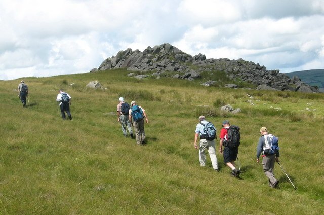
The glacier camp was unimpressed. Brian John and others argued that the recesses were natural, produced by frost-shattering along the rock's own joints and slabs; that the "quarry hearths" showed only that people had spent time on the site, not that they had been there to extract megaliths; and that the whole interpretation was a case of seeing what you were determined to see. The two sides settled in for another round of long-running argument in the journals, and to a general reader looking on, it was very hard to tell who was right. Both parties were experienced scientists, both were pointing at real features of the landscape, and neither had any way to check the one question that would settle everything: whether or not ice had ever reached Salisbury Plain.
Why zircon does not lie
That is the question the January 2026 paper set out to answer. The study, published in the journal Communications Earth & Environment, was led by Anthony Clarke, a researcher in the Timescales of Mineral Systems Group at Curtin University in Perth, working with the geologist Chris Kirkland. Their target was not the bluestones themselves but the ground under them: specifically, the sands and sediments in and around the rivers that drain Salisbury Plain today.
The reasoning behind the study is elegant. If glaciers had ever swept across Wales and Somerset and dumped debris on Salisbury Plain, carrying with them, in the process, the bluestones now standing at Stonehenge, then that debris would not have vanished when the ice melted. Rocks weather and crumble, but the tough minerals inside them survive. They wash into streams and rivers, get stirred into sediment, and stay there for tens of thousands of years, an inconvenient bit of luggage the landscape cannot shake off. Chief among these durable minerals is zircon, a hard silicate crystal that resists heat, weathering and time, and that carries inside itself a chemical signature, an isotopic fingerprint, of the rock in which it originally formed.
Zircon fingerprints from Welsh mountains are not the same as zircon fingerprints from the chalks of the local Salisbury area. If the Irish Sea Glacier had reached the Plain, the river sands should be full of grains carrying the wrong signature: telltale Welsh, or Somerset, or Bristol Channel zircons stranded in a landscape they have no business being in. If it had not, those grains would simply be absent.
The team analysed more than five hundred zircon grains recovered from river sediments close to Stonehenge, dating each one to establish its origin. The result was, in scientific terms, unambiguous. There were no grains with the isotopic signature that a Welsh or south-western glacial source would have produced. The sediment record on Salisbury Plain, in Clarke's phrasing, contains no trace of the ice ever having come this far east.
"We looked at the river sands near Stonehenge for some of those grains the glaciers might have carried and we did not find any."— Anthony Clarke, Curtin University, lead author of the 2026 study in Communications Earth & Environment
The Salisbury Plain, in other words, was not glaciated during the Pleistocene. No sheet of ice ever crawled this far into southern England and dropped a load of foreign rocks conveniently at what would one day be Amesbury. If the bluestones are on Salisbury Plain, they had to be brought there by someone.
How you carry an elephant across Wales
Which returns the argument, a century after Thomas started it, to the difficult second question: how? The 2026 study can tell us that human transport is the only possibility left standing; it cannot tell us the route or the technique. Two general options have been chewed over for decades. One is the overland route: sledges, log rollers and ropes, hauling stones down from the Preseli ridge across country to the Severn estuary, then floating them somehow along the Bristol Channel and up the Somerset rivers before a final overland pull to the Plain. The other is a coastal route: dragging the stones a shorter distance to the coast of Pembrokeshire, then loading them on some form of raft or lashed-hull boat and taking them the long way round the south-west peninsula of Wales, up the Bristol Channel and inland.
A five-tonne bluestone is the weight of a large elephant. Neolithic Britain had no wheels, no metal tools, no draught animals capable of pulling that kind of load, and no written record of how anything got done. Every plausible reconstruction (greased log rollers, hide-bound sledges, wooden A-frames, dugout catamarans) has been proposed and modelled, but no clinching evidence for any single method has survived on the ground.
Experimental archaeology has been chipping away at both possibilities for years. Teams working in Wales and Wiltshire have pulled replica stones on wooden sledges over greased logs, floated similar loads on lashed dugout canoes, and shown that a well-organised group of a few dozen people can, at least in principle, move a small bluestone-sized block a useful distance in a day. What no experiment has produced is a smoking gun: a preserved sledge fragment, a beached raft, a well-worn trackway lined with abandoned stones that would tell us this is really how it happened. The most honest answer to how the bluestones got to Salisbury Plain is still that we do not know, only that human beings were the ones doing it.
The stone that came from Scotland
While the Welsh argument was being settled, a much stranger detail was making the whole story harder. In August 2024, a team led by researchers from Curtin University and Aberystwyth University published a paper in the journal Nature about the Altar Stone, the six-tonne slab of grey-green sandstone that lies flat at the centre of the monument. Geologists had always assumed the Altar Stone was Welsh, like the rest of the bluestones. The new paper matched its mineral signature not against Wales at all, but against sandstones from the Orcadian Basin in the far north-east of Scotland, a geological formation running along the coast from around Inverness up to Caithness and out into the Orkney Islands.
That is not a slight readjustment of the picture. It is a rewriting of it. The Altar Stone had come from something like seven hundred kilometres away (roughly the distance from London to the Franco-German border) and had, at some point in the third millennium BC, been moved to the same spot on Salisbury Plain as the Welsh bluestones. It is very hard to think of a natural process that would drop a piece of Caithness sandstone into a monument in Wiltshire alongside forty stones from Pembrokeshire. That degree of specific, deliberate importation of stone from separate corners of the island points, again, to people doing it on purpose.
Taken with the 2026 zircon paper, the Altar Stone finding closes a lot of doors. It is no longer possible to argue that Stonehenge is a monument built out of whatever glacial rubbish happened to be lying about. Its designers were sourcing specific rocks from specific places, and moving them enormous distances in an era before the wheel. Something that we would now recognise as a project, with a plan, a workforce, and a purpose important enough to justify the cost, was going on across late-Neolithic Britain, tying the far north of Scotland, the west of Wales and the chalk downs of southern England into a single, extraordinary enterprise.
Why anyone bothered
The deepest question the bluestones raise is not how they got to Salisbury Plain but why anyone thought it worth the effort. Neolithic Britain was not a rich society. Its people were farmers living in small timber houses, without cities, kings, or, as far as we can tell, the kind of centralised power that later empires would use to command labour. Yet at least three separate long-distance stone-transport projects converged at Stonehenge over several centuries: the sarsens from West Woods, the bluestones from Preseli, and the Altar Stone from what is now Caithness. That did not happen because someone ordered it. It happened because enough people, spread across enough of the island, cared enough to do it.
Modern researchers have started to talk about Stonehenge less as a religious monument in any narrow sense and more as a unifier: a project whose real purpose may have been the act of building it together, drawing labour and materials from across the whole of an emerging British world and welding those contributions into a single visible thing. If the Altar Stone really did come from Orkney, its journey is not just an engineering curiosity. It is a piece of political archaeology, evidence that the communities of the far north felt themselves to be part of the same story as the communities of the south. That kind of shared identity, five thousand years old, is a rare and precious thing to be able to see.
What is left to argue about
Not everyone is convinced. Brian John has continued, since the 2026 paper appeared, to argue that the study proves less than it claims: that its sampling missed the traces of an older, less clean glaciation, that isolated erratics can still have reached the Plain even without a full ice cover, and that archaeologists are once again claiming victory prematurely. Debates like this tend not to end with one paper. They wind down slowly, as new evidence keeps failing to support the losing side.
What has changed is the burden of proof. For most of the twentieth century, someone arguing for human transport of the bluestones had to explain how a Neolithic society without wheels or metal could move eighty tonne-scale blocks across half of Britain, in the face of a plausible-sounding alternative. After January 2026, the argument runs the other way: anyone arguing for glacial transport now has to explain why the zircon record on Salisbury Plain shows no glacier ever arrived, and why an Altar Stone from Scotland ended up buried at the heart of a Wiltshire monument. Those are harder questions.
Herbert Thomas, who died in 1935, never lived to see the argument reach its punchline. He would have liked the zircons, though. He was a microscope man, someone who trusted the fine grain of the evidence over the sweep of the story. It has taken a century of instruments getting better, of tools getting sharper, and of two continents' worth of geologists arguing across their journals to end up almost exactly where he began: with a bit of dark, spotted stone from Pembrokeshire, standing in a field in Wiltshire, and no way to explain it except that somebody meant it to be there.
Read next: Newgrange: The Tomb Built to Catch One Sunrise a Year and Yonaguni: The Sunken Monument Nobody Can Prove Was Built.
Sources & further reading
- A. J. I. Clarke, C. L. Kirkland et al., "Detrital zircon evidence rules out glacial transport of Stonehenge megaliths," Communications Earth & Environment (2026), DOI 10.1038/s43247-025-03105-3.
- A. J. I. Clarke et al., "A Scottish provenance for the Altar Stone of Stonehenge," Nature (August 2024).
- H. H. Thomas, "The source of the stones of Stonehenge," The Antiquaries Journal 3 (1923).
- M. Parker Pearson et al., "Craig Rhos-y-felin: a Welsh bluestone megalith quarry for Stonehenge," Antiquity 89 (2015); "Megalith quarries for Stonehenge's bluestones," Antiquity 93 (2019).
- B. John, The Bluestone Enigma: Stonehenge, Preseli and the Ice Age (2008), and subsequent papers arguing the glacial-erratic case.
- Mike Parker Pearson, Stonehenge: A New Understanding (2012) — accessible narrative of the excavations that reopened the whole question.
Image credits (via Wikimedia Commons): Stonehenge stone circle at sunset (featured) — Simon Banton (CC BY-SA 4.0); Carn Menyn bluestones — ceridwen (CC BY-SA 2.0); Carn Goedog — Alan Richards (CC BY-SA 2.0); Stonehenge plan — Adamsan (CC BY-SA 3.0); Preseli Hills panorama — Helge Klaus Rieder (CC0).