In the late summer of 1296 a Chinese envoy named Zhou Daguan stepped off a river boat and walked into the busiest city on earth. He had come up the Mekong and across the great lake of the Tonle Sap on a diplomatic mission from the court of Kublai Khan’s grandson, and what he found he wrote down in plain, curious prose. Gilded towers. A stone bridge lined with giant carved serpents. Markets run by women, squatting on mats spread over the ground. A king who rode out on an elephant with a gold sword, past ministers and princes on their own mounts, under parasols of gold. Zhou stayed the better part of a year and filled a small book with what he saw. It is the only eyewitness account we have of Angkor while it was still alive, and every line of it argues against the story most people have been told about the place.
That story goes roughly like this. Deep in the Cambodian jungle there is a lost city, swallowed by the forest, its temples strangled by fig roots, forgotten by the world until a French naturalist stumbled upon it in the nineteenth century and gasped. It is a wonderful story. It is also, in almost every particular, wrong. Angkor was never lost. It was the beating heart of an empire that ran for six hundred years, a capital so large that we are still arguing about how many people lived in it, and it did not vanish in a night or a decade. What happened to it is stranger and slower than any jungle legend, and the best clues we have come from lasers flown over the treetops and from the rings of a single old tree growing on a mountain in Vietnam.
The city that was never lost
Start with the man who is supposed to have found it. Henri Mouhot was a French naturalist who reached the ruins in 1860, collecting beetles and shells, and whose journals, published after he died of fever in Laos, carried word of Angkor to a wide European audience. His drawings were beautiful and his prose was breathless. He wrote that the temples were “grander than anything left to us by Greece or Rome,” and he wondered aloud how a people he considered primitive could ever have raised them. That last question is the poison in the well, and we will come back to it.
Mouhot did not discover Angkor. He said so himself; local people guided him there. Buddhist monks had kept the great temple of Angkor Wat in use as a working shrine, without a break, from the day it was built. Pilgrims from Japan came in the seventeenth century and left inscriptions on its walls; one drew a plan of the temple and, back home, labelled it as a holy site in India, because he could not imagine such a thing standing anywhere else. A Portuguese friar, António da Madalena, walked the galleries in 1586 and reported a structure “so extraordinary that it is not possible to describe it with a pen.” Spanish adventurers came looking for it. The place had a caretaker village and a resident abbot when Mouhot arrived. The only people to whom Angkor was ever lost were Europeans who had not yet been.
Why does this matter? Because the lost-city myth does two things at once. It makes the ruin more romantic, and it makes its builders more mysterious, as though the Khmer had put up these towers and then wandered off, leaving the forest to reclaim what they could not manage. The truth is the opposite. The Khmer never let go of Angkor Wat, and the reason the wider city fell quiet has nothing to do with people forgetting how to live there and everything to do with a problem that no amount of memory could solve.
What the lasers found
For a long time the argument about Angkor’s size ran into a simple obstacle: the forest. You could map the stone temples, because stone survives and pushes up through the canopy, but the city that surrounded them was built of wood, thatch and earth, and all of that had rotted into the ground centuries ago. Scholars suspected a large population but could only guess at it. The temples looked like islands. Nobody could see the sea they sat in.
Then, in 2012, a light aircraft began flying grids over the Angkor region with an instrument strapped underneath it, firing hundreds of thousands of laser pulses a second at the ground below. The technique is called lidar, and it works by measuring how long each pulse takes to bounce back. Most pulses hit leaves. A few slip through the gaps to the forest floor, and by keeping only those you can strip the trees away digitally and look at the bare earth as it has not been seen in six hundred years. The survey was led by the archaeologist Damian Evans, and when the first images came back the effect on the people looking at them was something close to vertigo.
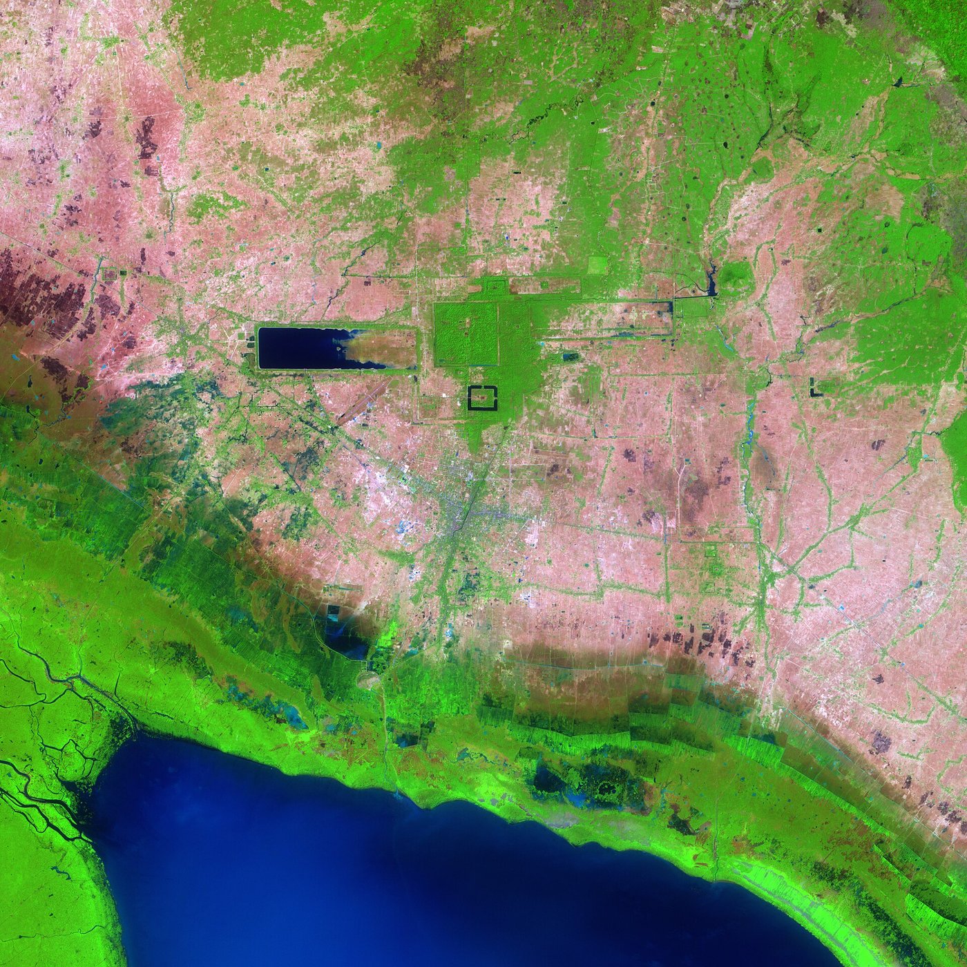
Under the bare-earth maps was a grid. Not just the famous temples but the ghost of a whole urban landscape: a lattice of roads, canals, embankments, house mounds and field boundaries running for kilometre after kilometre in every direction. The dense core alone covered something like the footprint of a modern city, and the low-density sprawl beyond it (farms, ponds, hamlets, all plugged into the same water grid) stretched across at least a thousand square kilometres. By surface area it was the largest settlement of the pre-industrial world, larger in extent than any city in medieval Europe. The trees had hidden a metropolis.
Estimates of Angkor’s peak population run from about 700,000 to perhaps a million people, spread across roughly a thousand square kilometres of low-density urban sprawl. For comparison, London in 1300 held maybe 80,000 souls inside its walls. Angkor was not a big town with grand temples. It was one of the most extensive cities humans had ever built, and it stayed that way for centuries.
That scale changes the question. A shrine can be abandoned on a whim. A city of three-quarters of a million people, feeding itself off engineered farmland, cannot. Something has to break the thing that keeps that many people fed. At Angkor, the thing that kept them fed was water.
A machine made of water
Cambodia has two seasons and they do not negotiate. For half the year the monsoon dumps rain by the metre; for the other half the land bakes and the rivers shrink. A rice-growing civilisation living on that rhythm has one overriding problem: how to hold on to the wet-season water so there is something to drink and something to grow when the dry months come. Angkor’s answer was to rebuild the landscape itself into a machine for catching, storing and moving water.
The largest parts of that machine are still there, and they are enormous. The West Baray, a rectangular reservoir dug by hand in the eleventh century, is about eight kilometres long and more than two wide, its banks raised in earth above the surrounding plain. Its older twin, the East Baray, is a similar size and now dry, a vast pale rectangle you can only really read from the air. Around every major temple ran a moat; between the reservoirs ran channels and spillways and embanked roads that doubled as dykes. The French scholar Bernard-Philippe Groslier gave the whole idea a name in the 1970s: the “hydraulic city.” He argued that Angkor was, at bottom, a giant water-management scheme with temples on top: the reservoirs fed the rice, the rice fed the people, and the people built the towers.
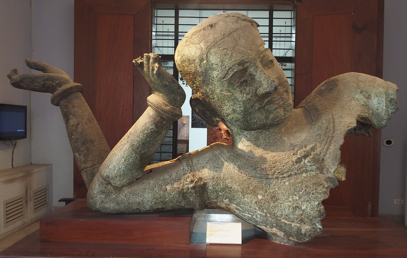
Groslier’s neat picture has been argued over ever since, and the modern view is more careful. The barays were not simply irrigation tanks; they had a religious meaning too, standing in for the cosmic ocean around the sacred mountain, and just how much of the farmland they watered directly is still debated. But the core of the idea has only grown stronger with the lidar maps. The water network was real, it was vast, and it was the thing that made the city’s scale possible. Nobody feeds a million people in monsoon country without controlling the water, and Angkor controlled it on a scale no one else in the medieval world attempted.
Zhou Daguan, the envoy of 1296, noticed the rhythm of the water without understanding the engineering behind it. He recorded that the Khmer could take three or four rice harvests a year, and that the level of the great lake rose and fell astonishingly between the seasons: land that was dry pasture in one month lay under many feet of water in another. He was describing, from the outside, a society built entirely around the management of wet and dry. He also noted, almost in passing, that the country was rich and the people at ease. He saw the machine working.
Arguments in stone
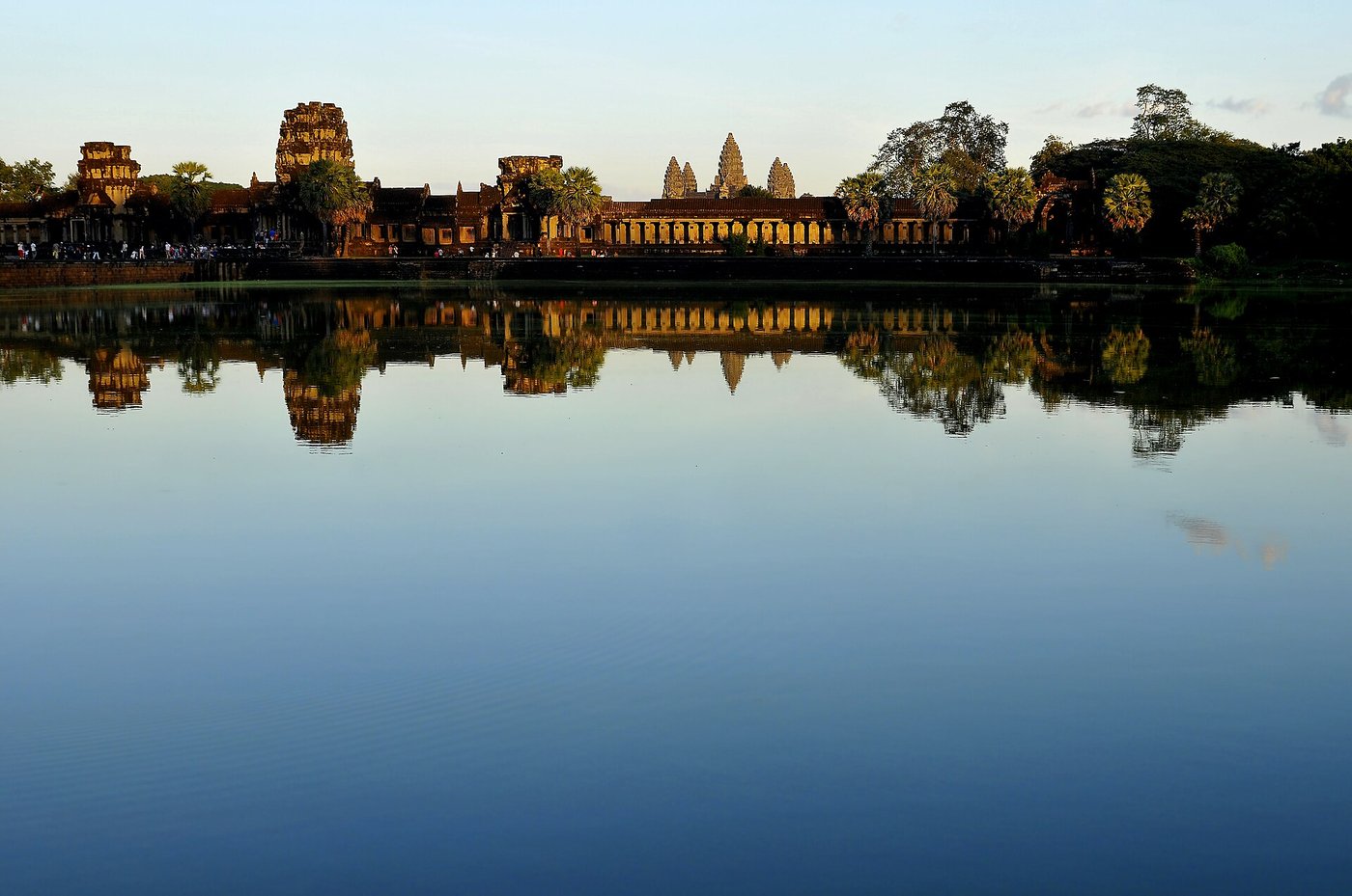
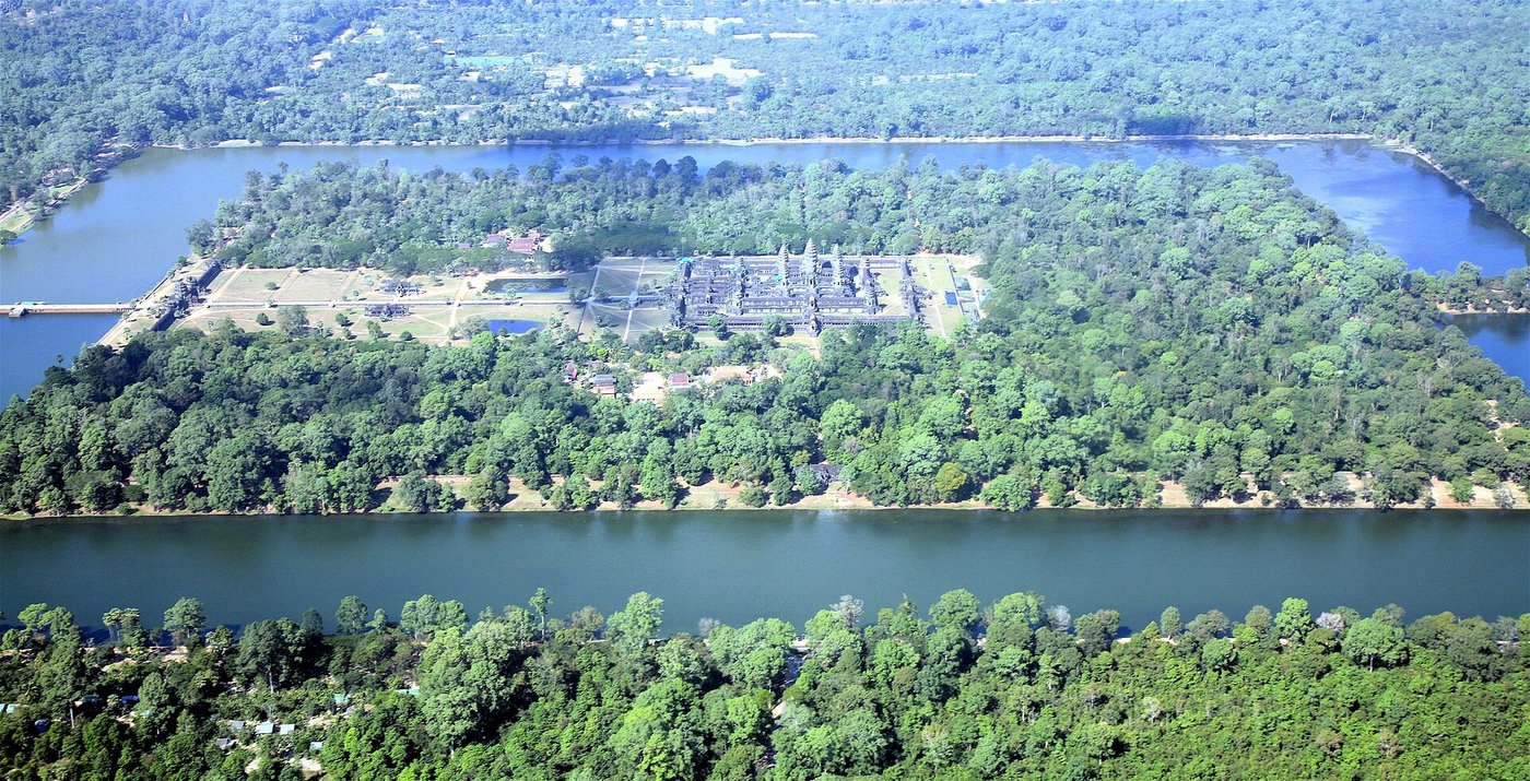
The temples were not decoration on top of the waterworks. They were how power announced itself. Each great Khmer king built his own state temple, a man-made mountain in stone meant to house a god and, through the god, the king’s own divine authority. Angkor Wat, the biggest and most perfect of them, went up in the first half of the twelfth century under Suryavarman II, dedicated to the god Vishnu and laid out to mirror the cosmos, with its five towers standing for the peaks of the mythical Mount Meru and its wide moat for the encircling ocean. It was a temple, an observatory of sorts, and a statement of reach all at once.
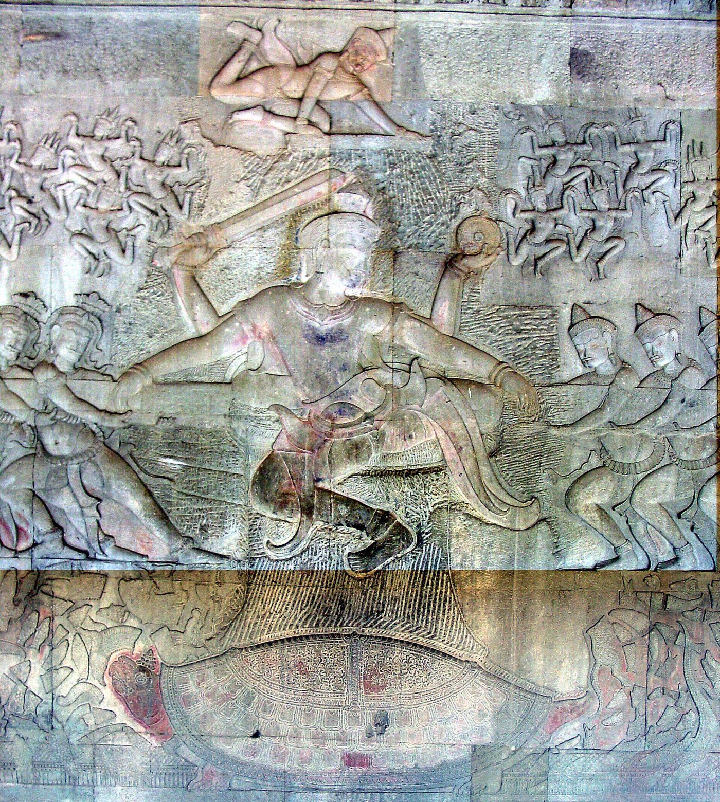
Walk the lower gallery of Angkor Wat and you pass one of the longest carved stories in the world. Hundreds of metres of bas-relief run along the walls, and among them is the myth the Khmer loved best: the Churning of the Sea of Milk. Gods on one side, demons on the other, both hauling on the body of a giant serpent wrapped around a mountain, spinning it to turn the ocean into the nectar of immortality. It is a scene about wringing life out of water by main force, carved into the walls of a civilisation that did exactly that with its rivers. The Khmer did not miss the resemblance.
Two generations later the mood changed. After a brutal war with the neighbouring Cham, who sacked Angkor in 1177, a new king came to the throne who would out-build even Suryavarman. Jayavarman VII took power around 1181, threw the Cham back, and launched a construction spree unmatched in Khmer history: hospitals, rest-houses, roads, and a new walled capital, Angkor Thom, at whose centre he raised the Bayon. And he did it as a Buddhist. The old Hindu god-kingship gave way, for a while, to a Buddhist one, and the change is carved into the stone: the towers of the Bayon are not abstract peaks but enormous serene faces, more than two hundred of them, gazing out over the four directions.
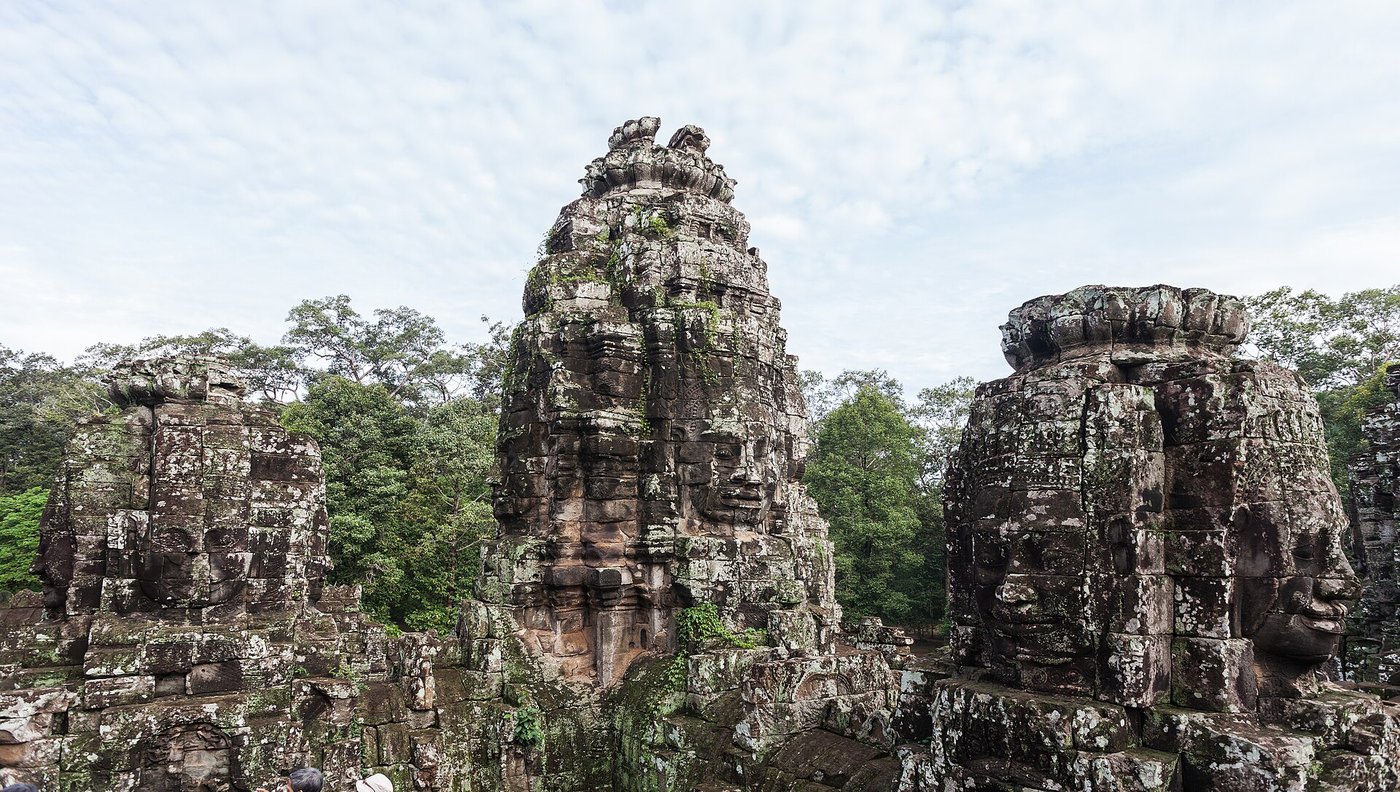
Whose faces they are has never been settled. Some read them as the compassionate bodhisattva Avalokiteshvara; some as the king himself; some as both fused into one, a ruler wearing the face of a god watching every road into his city. Whatever the answer, the ambition is plain. By the end of the twelfth century Angkor had reached the height of everything: population, farmland, monuments, reach. From here the only direction was down, and it took a long time to go.
The rings of a Vietnamese cypress
To understand the fall you have to leave the ruins and go to a mountain in the central highlands of Vietnam, where a species of cypress called Fokienia hodginsii grows slowly and lives for many centuries. In the trunks of the oldest of these trees is a written record of the weather, one ring for every year: fat rings in wet years when the tree drank its fill, thin rings in dry ones when it went thirsty. A team led by the climate scientist Brendan Buckley cored these trees and read the record back through the Angkorian centuries. What they found landed like a verdict.
The rings recorded two long, savage droughts at exactly the wrong moment. The first ran from roughly 1345 to 1374, a drought lasting a full generation. The second, from about 1401 to 1425, came right on top of the recovery. Between and around them were years of unusually violent monsoon. The climate did not simply dry out; it lurched, swinging from crippling drought to torrential flood and back. For a civilisation whose entire existence depended on a water network tuned to a reliable wet-and-dry rhythm, this was close to a worst case. The droughts starved the reservoirs. The violent monsoons that broke the droughts then hit the network like a hammer.
That second part is the cruel twist, and the physical evidence for it is in the ground. Where the canals and spillways meet, archaeologists have found the water infrastructure choked with coarse sand and rubble, and structures crudely patched, rebuilt and finally bypassed. A network this size, built up over four centuries, had grown into a single interlocking machine, and a machine that big is rigid. When floods tore out a spillway or dumped a bank of sediment across a channel, the damage did not stay local. It cascaded. Repairing it needed exactly the kind of centralised command of labour that a state weakened by drought, war and upheaval was steadily losing. The thing that had made Angkor mighty, the sheer scale and interconnection of its waterworks, was the same thing that made it impossible to fix once the climate turned.
No serious researcher says drought alone emptied Angkor, and Buckley himself was careful: “I wouldn’t say climate caused the collapse, but a thirty-year drought had to have had an impact.” By the fourteenth century the Khmer state was already under strain from other directions: costly wars, a shift in religion, and a growing pull toward the sea and the money in maritime trade with China. The climate did not act on a healthy empire. It acted on one that was already changing, and it turned a difficult century into an impossible one. The honest answer is that Angkor came apart from several causes braided together, with the failing water network as the thread that snapped last.
The jungle did not eat the city
In the popular image, Angkor fell all at once: a great catastrophe emptied the temples, the people fled, and the jungle poured in and swallowed the whole city, its towers left to be strangled by trees until European explorers hacked their way in and found it frozen mid-collapse.
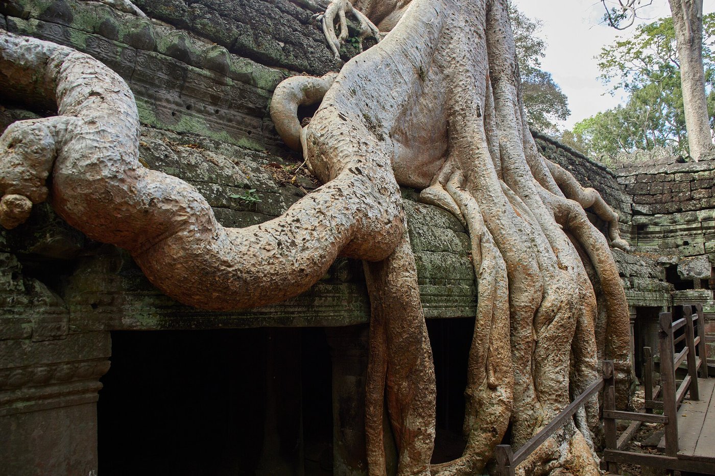
Nothing about it was sudden. Angkor drained away across more than a century, as farmers and nobles drifted toward the growing towns of the south, nearer the coast and the trade routes. In 1431 the rival Thai kingdom of Ayutthaya sacked the city, and the court moved its centre of gravity toward Phnom Penh, closer to the sea. But even then Angkor was not deserted. Angkor Wat stayed a living temple with monks and pilgrims the whole time. What retreated was the sprawling farmed hinterland, no longer worth the immense effort of maintenance, and the forest simply moved back into the fields people had stopped tending. The famous fig-strangled ruins of Ta Prohm are real, but they are a slow reconquest of abandoned suburbs, not the crime scene of a city killed in a night.
The long leaving
Picture it not as a fall but as a tide going out. Through the fourteenth and early fifteenth centuries the reasons to stay at Angkor weakened one by one. The rice economy grew unreliable as the water grid decayed. Money moved to the coast, where ships from China wanted pepper, wax and forest goods, and a capital in the deep interior was far from that trade. A new form of Buddhism, the Theravada school still followed in Cambodia today, spread among ordinary people and had less use for the colossal state temples that justified a god-king’s power. The centre of the kingdom slid south toward Phnom Penh, sitting at the meeting of great rivers, well placed for the sea.
The 1431 sack by Ayutthaya is often given as the date Angkor “fell,” and it made a neat headline for later historians, but it was more a symptom than a cause. A strong, well-watered Angkor had beaten off worse. This was a blow landed on a place that was already hollowing out, and it helped tip a long decline into a decision. The kings left. Many of the people left. The great reservoirs, no longer dredged and repaired, silted up and grew over. The moats turned green. The wooden city rotted back into the soil that the lidar would one day read like a page.
And yet the most-repeated fact about Angkor, that it was abandoned and forgotten, stayed false to the end. Through every one of those centuries, monks swept the galleries of Angkor Wat and lit lamps to the gods and later the Buddha. The temple never closed. It is on the national flag of Cambodia now, the only building in the world to feature on a country’s flag, and it has been on every flag the country has flown, through kingdom, colony, republic and even the horrors of the Khmer Rouge. A place that supposedly no one remembered has been the emblem of a nation without a break.
The lasting lesson of Angkor is not a warning about lost cities. It is about the price of success. The Khmer solved the hardest problem in their world (how to feed a million people in a land of drought and deluge), and they solved it so completely, on such a scale, that the solution became a thing too large and too rigid to save when the weather stopped behaving. The forest on the towers is the part everyone photographs. The real story is written in the choked sand of a canal, and in the thin rings of a tree that was alive to feel the rain fail.
Read next: My Son Sanctuary: The Road for the Gods Buried for Centuries and Bagan: The Temple Boom That Helped Bankrupt a Kingdom.
Sources & further reading
- Brendan M. Buckley et al., “Climate as a contributing factor in the demise of Angkor, Cambodia,” Proceedings of the National Academy of Sciences 107 (2010) — the tree-ring record of the Angkor droughts and the monsoon extremes.
- Damian Evans et al., “Uncovering archaeological landscapes at Angkor using lidar,” PNAS 110 (2013) — the airborne laser survey and the scale of the low-density city.
- Roland Fletcher, Damian Evans, Christophe Pottier and Chhay Rachna, “Angkor Wat: an introduction,” Antiquity 89 (2015) — on the hydraulic city and its water network.
- Zhou Daguan, A Record of Cambodia: The Land and Its People, trans. Peter Harris — the 1296–97 eyewitness account of Angkor while it lived.
- Michael D. Coe and Damian Evans, Angkor and the Khmer Civilization (Thames & Hudson) — a full modern survey of the city, its kings and its end.
- Bernard-Philippe Groslier, “La cité hydraulique angkorienne,” Bulletin de l’École française d’Extrême-Orient (1979) — the original statement of the hydraulic-city thesis.
Image credits (via Wikimedia Commons): Angkor Wat reflected in its moat (featured) — LBM1948 (CC BY-SA 4.0); the Angkor region from space — NASA (public domain); fragment of the reclining bronze Vishnu from the West Mebon — Clay Gilliland (CC BY-SA 2.0); Angkor Wat and its moat from the air — Steve Jurvetson (CC BY 2.0); Vishnu and the Churning of the Sea of Milk, Angkor Wat — Michael Gunther (CC BY-SA 4.0); the faces of the Bayon, Angkor Thom — Diego Delso (CC BY-SA 3.0); fig roots over the ruins of Ta Prohm — lumoplank (CC0).