On a morning in August 1969, American aircraft came in low over a narrow valley in central Vietnam and turned the finest building the Cham people ever raised into a heap of warm brick. The tower was called A1. It had stood for something like a thousand years, close to twenty-four metres of red brick climbing in tiers towards a stone summit, and it came down in an afternoon because soldiers were sheltering among the temples and the temples were in the way. What the bombs left was rubble, craters that still scar the grass, and a scatter of steel that clearing teams are careful about to this day. It seemed, for a while, like the last word on the place. Then in 2025 a trench opened a few steps away, and the ground handed back something that neither the bombers nor the mapmakers before them had ever noticed was there.
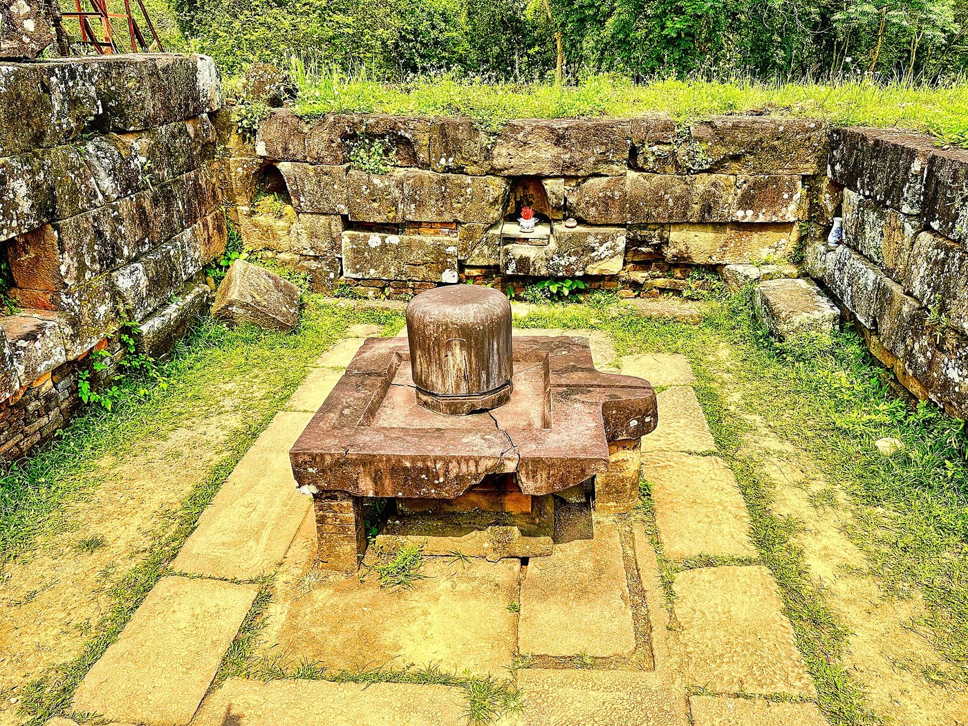
The valley is called My Son, and almost nothing about it matches what a visitor expects of Vietnam. There are no pagodas here, no incense-blue Buddhist courtyards. There are brick towers with the profiles of Indian temples, dedicated to Shiva, carved with dancers and lions and the god's own emblem in stone. For roughly a thousand years this was the holiest ground of a kingdom called Champa, a sea-facing power that traded across half the world and then slipped so completely out of the story that many people who live nearby have only the haziest idea it existed. The 2025 discovery matters because it does something rare. It puts the crowds, the priests and the kings back on their feet and shows you where they walked.
A bowl of hills the kings chose on purpose
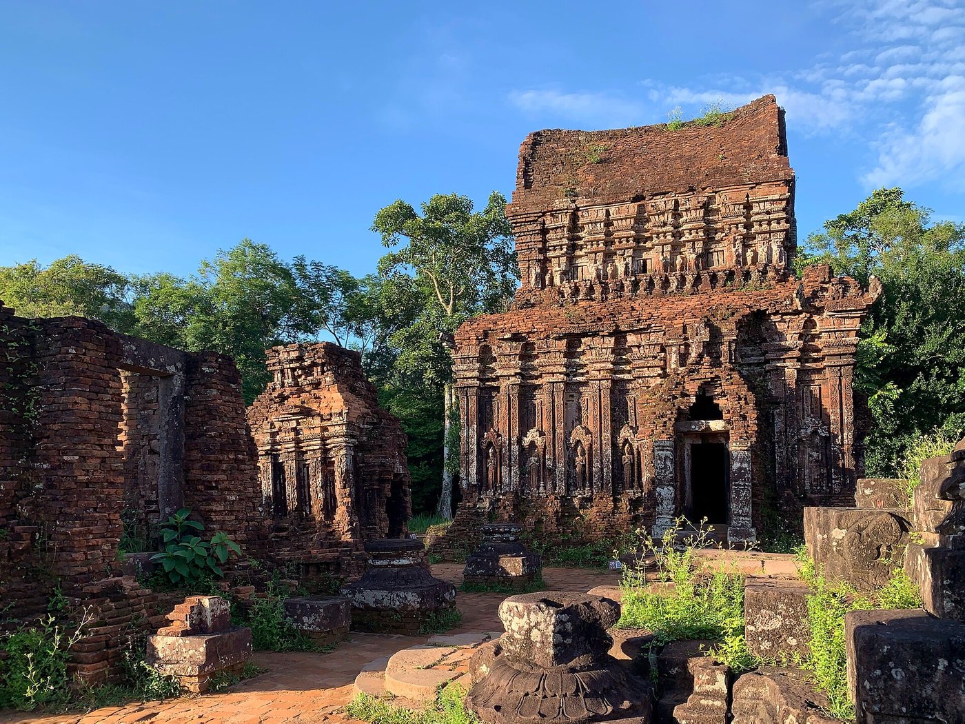
My Son sits in a ring of low green mountains about forty kilometres inland from the old trading coast near modern Hoi An and Da Nang. A stream loops through it. One peak on the southern side rises in a shape the Cham read as sacred, and they gave it a name that meant the great mountain, treating the whole bowl as a natural temple with the towers set down inside it. Damp air, thick forest, a hidden position off the main roads: it was a place made for ritual rather than defence, and the choice tells you what the valley was for.
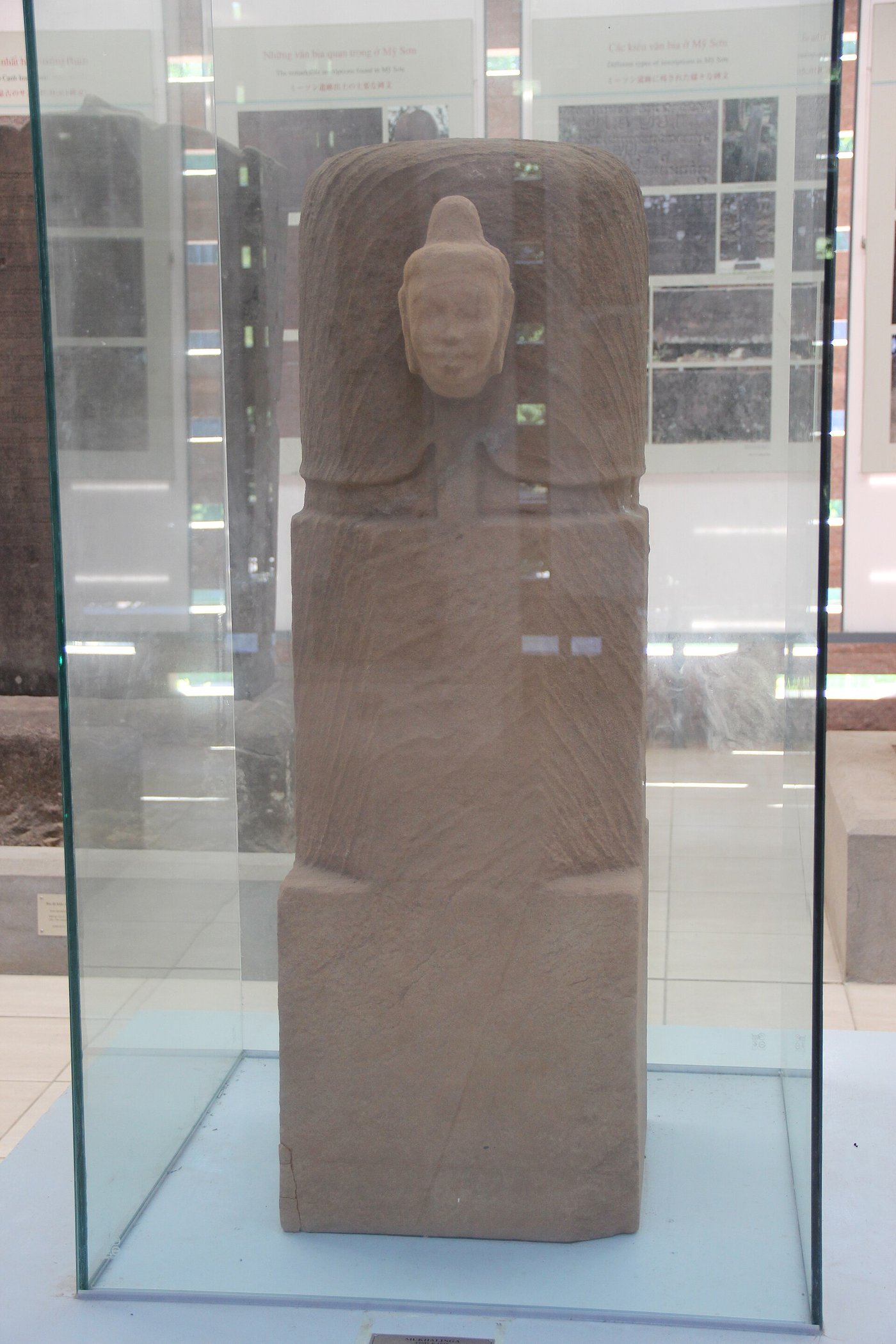
The story starts late in the fourth century with a king the inscriptions call Bhadravarman. He built the first shrine here, a wooden hall around a stone linga, and dedicated it to Shiva under a joined-up name that fused the god's title with his own. God and king, bound together in one word carved in stone. That habit of divine kingship would run through Champa for the next eight hundred years, and it is the reason the valley kept being rebuilt. A fire took the wooden temple a century or two later. Early in the seventh century a king remembered as Sambhuvarman raised it again, this time in brick, and brick is what My Son has spoken in ever since.
Close to the old capital, a short walk from the sanctuary, sits a piece of stone that outranks all of it. The Dong Yen Chau inscription is scratched in the Cham language and dates to about the same late-fourth-century moment. It is the oldest known writing in Cham, and, as far as anyone can show, the oldest surviving text in any Austronesian language at all, the vast family that reaches from Madagascar to Easter Island. It is not a royal boast. It is a curse laid on anyone who would harm the property of a local serpent-god, ordinary belief caught in the act. Before the Cham wrote hymns to imported gods, they wrote down their own.
A kingdom that lived with its back to the mountains and its face to the sea
To understand the towers you have to drop the idea of Champa as a single tidy country with a capital and a map. It was a string of principalities strung along the coast of what is now central and southern Vietnam, each based on a river mouth, each with its own harbour and its own big men. Amaravati around here in the north, Vijaya further south, then Kauthara and Panduranga. Sometimes a strong king pulled them together. Often he did not. What held them in one culture was not a government. It was the sea, a shared language, and a shared set of gods borrowed from India and made their own.
The wealth came off the mountains and out of the forests behind the ports. The Cham controlled the passes to the highlands, and through those passes came the one thing the medieval world could not get enough of.
The forests inland from My Son grew a diseased, resin-soaked heartwood called agarwood, or eaglewood, and the finest grade of it, kinam, was worth many times its weight in gold. Burned, it gave a scent that Chinese emperors, Arab perfumers and Japanese incense masters would pay almost anything for. Champa sat on the supply. That is the real engine under the temples: not farming, not conquest, but a fragrant lump of wood that a merchant in Baghdad or Kyoto could not source anywhere else. The Cham took gold and silk for it, and turned a good share of the profit into brick and stone for Shiva.
Traders in Cham ports dealt in that wood, in ivory, in rhino horn and sandalwood, and they plugged the valley into a network that ran to China, to India, to the Muslim ports of the west. The gods came up the same routes as the goods. Shiva above all, then Vishnu, the Sanskrit language for royal inscriptions, the whole apparatus of Indian kingship, all of it adopted by a people who kept their own tongue for the curse-stones and their own eye for the way a face should be carved.
The road east of Tower K
For more than a hundred years, everything written about My Son leaned on the French. When Camille Paris stumbled on the overgrown valley in 1898, the towers had been swallowed by forest for generations. Scholars from the French research school in the Far East came in behind him, and one of them, Henri Parmentier, did the work that everyone since has built on. He sorted the ruins into groups and labelled them with letters, A through to the far end of the alphabet, and numbered the towers inside each group. His plans were so thorough that for a century it felt as if there was nothing left to find, only things to save.
Tower K stands a little apart from the main clusters, a small gate-tower on the western edge, and for decades people assumed it was simply a doorway you passed through on the way in. Then, digging season by season from 2023 into the second half of 2025, a Vietnamese team working east of Tower K uncovered something Parmentier's plans never showed: a made road, running straight from the gate towards the great temple groups at the centre.
The road runs about seventy-five metres long and nine metres wide. It is bounded on each side by low brick walls, set on foundations of ground brick and crushed pebble, and its surface is a compacted crust of sand, gravel and brick dust laid to a depth of fifteen to twenty centimetres. Along one of those guide walls the diggers found the openings for five separate gates. Pottery trodden into the surface dates the whole thing to the tenth to twelfth centuries. None of it appears on a single French drawing. It had been lying under the topsoil, a few strides from towers that thousands of tourists photograph every year, for the better part of a millennium.
The archaeologists reading it, among them the veteran Cham scholar Ngo Van Doanh, do not think this was a cart track. A processional way is how they describe it, a sacred road built so that the gods, carried in image and in procession, and the kings and priests who served them, could enter the sanctuary along a route that was itself part of the ritual. Walls to hold the crowd back. Gates to mark the stages of approach. A surface kept clean and level for feet that mattered. For the first time, My Son is not only a set of buildings. It is a stage with the blocking still marked on the floor, and it changes how the whole valley is meant to be read: not as scattered shrines, but as one long, deliberate walk towards the god.
The brick with no seam
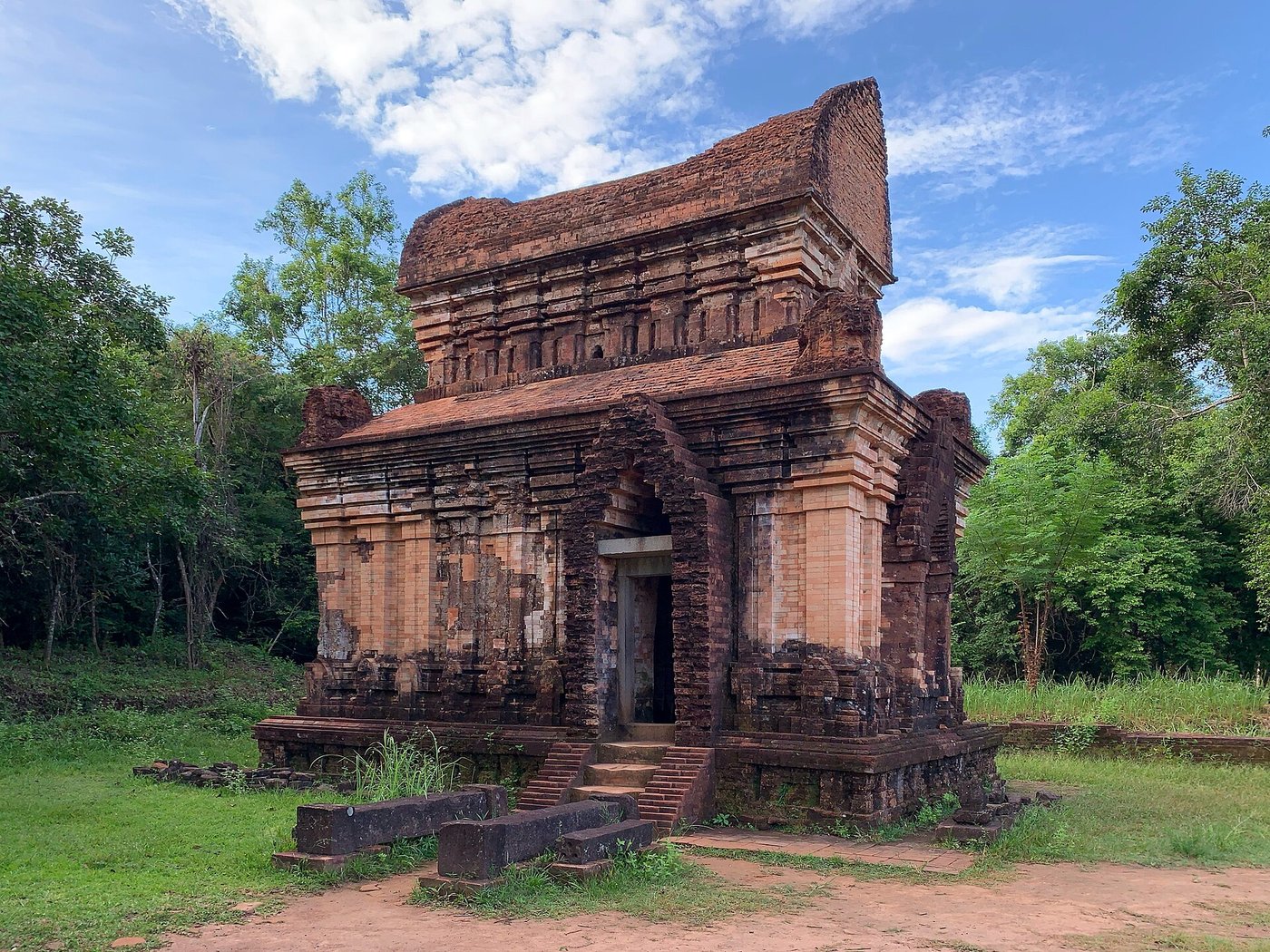
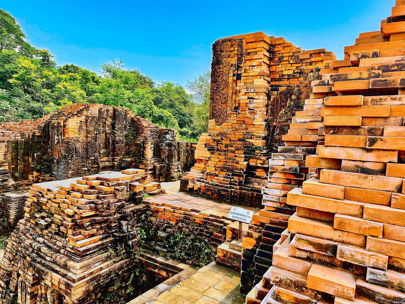
Stand close to a Cham tower and you notice something your eye cannot quite explain. The bricks meet so tightly that there seems to be no mortar at all, no grey line between them, and the carving of leaves and figures runs across the joints as if the whole wall were cut from one solid block. It is not. It is thousands of separate bricks. How the Cham bonded them, and how they carved a finished wall without cracking it, is a question that has kept restorers arguing for over a century.
The story often told is that the Cham possessed a lost secret, a magical mortar or a forgotten firing trick that no modern builder can reproduce, so that every attempt to repair a tower fails and the knowledge died with the last Cham mason.
The plainer truth is that the secret has been coming apart under study for years. The bricks were soft when carved and hardened later; the binding agent, most researchers now think, was a resin tapped from the local dau rai tree, a forest oil that is strong, waterproof and available by the barrel from the same hills that grew the incense wood. Early restorers really did make a mess, slapping modern cement between ancient bricks so that the new work trapped water and rotted the old. But that was clumsiness, not lost magic. Careful teams have since rebuilt sections that hold. The Cham were superb engineers working with local materials, not sorcerers.
Whatever the exact recipe, the result has lasted in a climate that eats stone. That is the quiet marvel of My Son. Damp heat, jungle roots, monsoon after monsoon, and still the towers stand, their carved sandstone lintels and brick tracery sharp enough to read. The Cham built to outlast their own kingdom, and they managed it.
The wars that made and unmade them
A people this rich and this exposed were never going to be left in peace. Champa spent its long life pressed between two heavyweights: the Khmer empire of Angkor to the west, and the growing Vietnamese state of Dai Viet to the north. Mostly the Cham held their own. Sometimes they did far more than that.
In 1177 a Cham king took a fleet up the rivers into the heart of Cambodia, fell on Angkor by surprise, sacked the Khmer capital and killed its ruler. For a few years the Cham occupied the greatest city in Southeast Asia. It did not last. The Khmer rallied under Jayavarman VII, threw them out, and carried the war back into Champa in turn. The two powers bled each other for a generation, and the temples of both still carry carvings of the fighting, Cham and Khmer warriors locked together in stone.
The end came from the other direction. Dai Viet had been pushing south for centuries, kingdom absorbing kingdom, and in 1471 a Vietnamese army broke the Cham capital at Vijaya for good. The numbers that come down to us are brutal: tens of thousands of Cham killed, tens of thousands more marched north as captives, the king among them. It was not a raid. It was the effective end of Champa as a power of any weight. A rump of the old world hung on in the far south, a shrinking vassal state, until a Vietnamese emperor swallowed the last of it in 1832. My Son itself had already fallen quiet long before, the priests gone, the forest moving back in over the gods.
What the bombs took, and what a drawing saved
The valley's worst century was its most recent. During the war in Vietnam the hidden bowl that had once made My Son perfect for ritual made it useful for something else, and it became a base. In August 1969 the bombing that destroyed tower A1 tore through the central groups, and the greatest single monument the Cham ever built was reduced to the mound of brick you can still see today. Craters pit the ground. Signs warn you to keep to the paths, because not everything that fell has gone off.
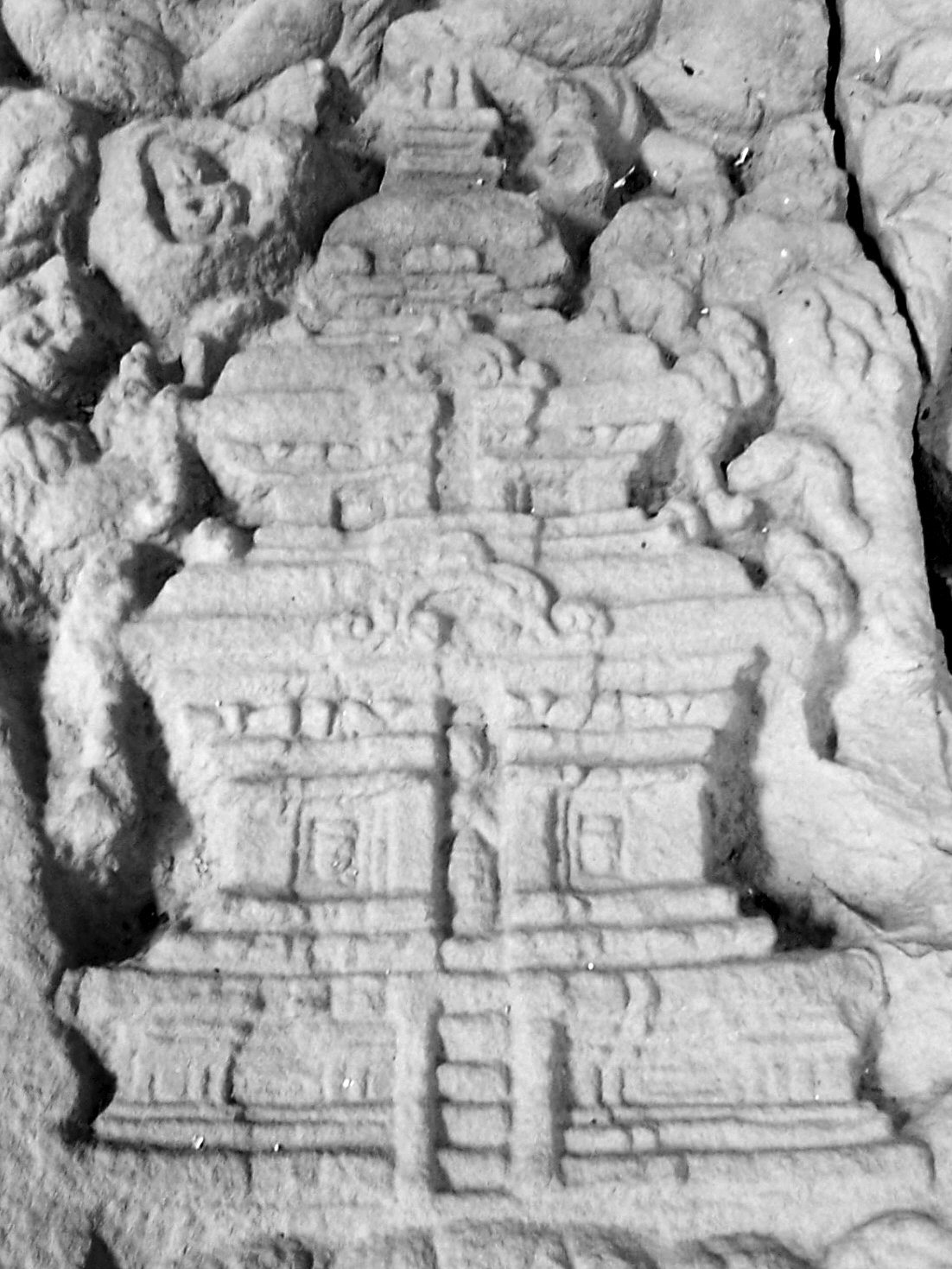
There is a strange mercy folded into the loss. Because the French had recorded the valley so exactly, in measured plans, photographs and casts made decades before the bombs, restorers know what was standing and where. A1 cannot be raised again from a drawing. But the drawing means the tower is not entirely gone; its proportions, its carvings, its place in the plan all survive on paper, waiting. In the years since, international teams have come to help stabilise what is left. An Indian conservation mission spent five years in the 2010s working on several of the groups, and it was that team, clearing around Tower K, that first found the pair of gates flanking it, the clue that told the later diggers there was more to look for out to the east.
The valley is still talking
The Cham did not vanish, whatever the tidy version of history suggests. Their descendants still live in central and southern Vietnam, some following a local form of Hinduism, some a local form of Islam, keeping festivals and language and memory that reach straight back to the towers. My Son is a ruin and a World Heritage Site and a place with a ticket office, but it is also, to the Cham, still theirs and still holy.
And it has not finished giving things up. A road nobody knew existed, five buried gates, a processional route for gods and kings, all of it under a thin skin of soil beside a monument the whole world thought it had already measured. If a made road that size could hide in the most studied valley in Cham archaeology, the honest guess is that My Son is keeping more. Somewhere under the grass, between the craters and the standing towers, the rest of the walk to the god is probably still there, waiting for the next trench. The dau rai trees that may have bound the bricks are still on the hills. The stream still loops through. And the road, cleared now, runs east from Tower K towards the temples exactly as it did when the last procession passed along it and the forest began to close in.
Read next: Bagan: The Temple Boom That Helped Bankrupt a Kingdom.
Sources & further reading
- UNESCO World Heritage Centre, “My Son Sanctuary” (inscribed 1999), whc.unesco.org.
- VietnamPlus / Vietnam News Agency, reporting on the 2023–2025 excavation of the sacred road east of Tower K, with comment from Ngo Van Doanh and Nguyen Thuong Hy.
- Henri Parmentier, Inventaire descriptif des monuments cams de l’Annam (EFEO, 1909–1918), the founding survey of the groups.
- Tran Ky Phuong, Vestiges of Champa Civilization (The Gioi, 2008), and his work on Cham brick and the dau rai resin question.
- Ian Glover & Nguyen Kim Dung, and the broader literature on Cham archaeology and the agarwood trade of Champa.
- Michael Vickery, “Champa Revised” (2005), on Champa as a federation of coastal polities rather than a single state.
Image credits (via Wikimedia Commons): My Son groups B, C and D, and Group A ruins — Ms Sarah Welch (CC0); My Son groups B, C and D and Temple E7 — Chainwit. (CC BY 4.0); ekamukhalinga of My Son — Gary Todd (CC0); carved brick tower detail — DoktorMax (public domain).