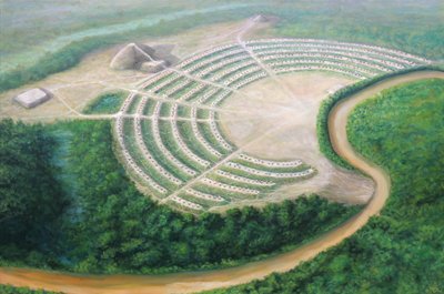
In 1953 James Ford spread a stack of aerial photographs across a desk and found a city hiding in plain sight. On the ground, the cotton fields of north-eastern Louisiana looked flat and unremarkable: a few low humps, a bayou, some scrub. From the air it was a different place. Faint curved lines ran through the fields, one inside the other, like ripples frozen around a stone dropped into the earth. Six great arcs, nested and regular, wrapped around an open square almost a kilometre across. Nobody standing in those fields for the past three thousand years had been able to see the shape they were walking on. It took a camera in an aeroplane to reveal that the ground itself had been drawn.
The place is called Poverty Point, after the hard-luck cotton plantation that sat on it in the nineteenth century. It is one of the strangest monuments in the Americas, and for a long time it was also one of the most misread. Everything about it seemed to demand a powerful ruler, a settled town, a chiefdom bending thousands of people to a plan. Then the people who dug it kept failing to find the ruler, the town, or the graves. What they found instead was stranger and, if the newest work is right, far more interesting: a giant built by people who owned almost nothing, farmed nothing, and answered, as far as anyone can tell, to no one.
A shape you cannot see from the ground
Start with the earth itself, because the earth is the artefact. Sometime between roughly 1700 and 1100 BC, on a low bluff above Bayou Macon, people laid out six C-shaped ridges, one inside another, opening towards the water. The outermost arc is about three-quarters of a mile from tip to tip. Walk across the whole nest of them and you cross more than a thousand years of intention, though the builders may have raised them in far less time than that.
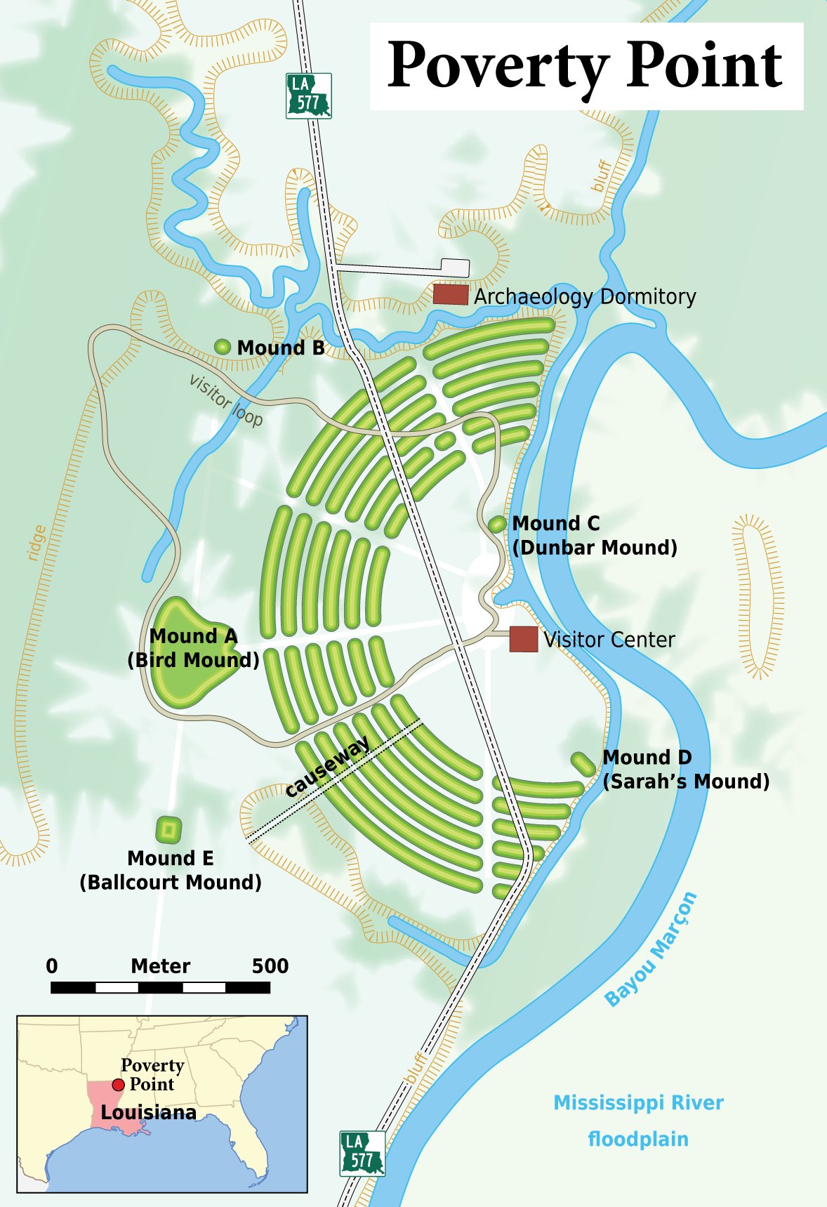
Inside the arcs lies a flat plaza of about thirty-eight acres. It looks natural. It is not. Excavation showed the builders had levelled and raised it deliberately, adding up to a metre of fill in places to iron out the slope, then setting rings of huge wooden posts into it: circles of timber up to sixty metres wide, found first by chance in the 1970s and later traced by magnetic survey across the whole open ground. Whatever happened in that plaza happened inside carefully placed rings of standing wood.
Off to the west stands the piece that makes visitors stop talking. Mound A is a T-shaped hill of earth about twenty-two metres high, wider at the base than two football pitches laid end to end. From certain angles people have read it as a bird with outstretched wings, its head pointing west. By volume it is the second-largest earthen mound anywhere in eastern North America. Only Monks Mound at Cahokia beats it, and Cahokia was raised more than two thousand years later, by a farming society with maize in its granaries and a dense population to draw on. Poverty Point had neither.
The people who built it owned no fields
This is the fact that reorders everything else. The builders of Poverty Point were hunter-fisher-gatherers. They grew no crops. They kept no herds. They had no pottery worth the name in the early centuries, and no metal tools of any kind. By the tidy sequence that archaeology inherited from the nineteenth century, people like this were supposed to be too few, too mobile and too poor to raise monuments. Farming was meant to come first, then surplus, then chiefs, then temples. Poverty Point does the sequence backwards.
Their food came off the land and out of the water around them: deer and small game, fish and turtles, mussels from the bayou, nuts and seeds and roots in season. To cook it they made small lumps of local clay, shaped by hand, baked hard, and dropped hot into earth ovens where they held and gave off heat like the stones a landscape without stone did not provide. Archaeologists dig these up by the tens of thousands and call them, without ceremony, Poverty Point Objects. A grooved ball of fired mud is the single most common thing the site has left behind: the everyday tool of people feeding a crowd.
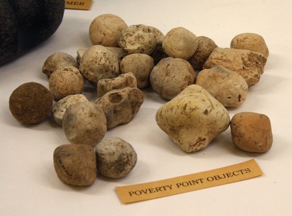
And that phrase matters more than it sounds. There is no stone at Poverty Point. The delta is river mud for a hundred miles in every direction. Yet the site is full of stone that was carried there.
Everything hard here was carried in
Sort the finds by where the raw material comes from and the map spreads across half a continent. There is soapstone, carved into bowls, from the southern Appalachians, six hundred miles to the east. There is galena, a heavy glittering lead ore, from the upper Mississippi valley in Missouri and Iowa. There is copper, hammered into beads and small tools, some of it from the Great Lakes and some, more recent testing suggests, from Appalachian sources closer to hand. There is quartz crystal from the Ouachita Mountains, and chert and flint from the Ozarks and the Ohio and Tennessee valleys, knapped into blades and into the small stone weights that helped throw a spear.
Soapstone from the Appalachians. Galena from Missouri and Iowa. Copper from the Great Lakes. Quartz from the Ouachitas. Flint from the Ohio valley. None of it grows in the delta mud, and none of it moved by wheel or pack animal; there were neither. It came down rivers and along foot trails, hand to hand, from as far as six hundred miles away, to a spot on a Louisiana bayou that had no stone of its own. Poverty Point sat at the centre of the widest trade web North America had yet seen.
None of this arrived by cart or by horse. The wheel was unknown here and would stay unknown for thousands of years; the horse would not return to the continent until Europeans brought it. Every gram of that stone came by river and on foot, passed along a web of paths and paddled trade that reached the Great Lakes in one direction and the Gulf in the other. Poverty Point was not a backwater that happened to grow large. It was a hub: a place worth walking hundreds of miles to reach.
Mound A: the bird that rose in a season
For years the obvious assumption was that a mound the size of Mound A must have gone up slowly, basket by basket, over generations, the way a cathedral grows across centuries. Then geologists looked closely at how the earth inside it was stacked, and the assumption fell apart.
When a pile of soil sits exposed to weather, it changes. Rain washes fine particles down. Roots work in. A thin crust forms, a skin of weathering that a trained eye can read like a pause button. If Mound A had been raised over decades, its interior should be full of those pauses: buried old surfaces, one above another, each marking a season when the work stopped and the rain came. There are almost none. Layer sits on layer with no weathered skin between them, which can mean only one thing: the earth went up fast, faster than the weather could mark it. The best estimate is that Mound A (something like two hundred and thirty-eight thousand cubic metres of soil, dug with wood and shell and carried in baskets on people's backs) was heaped up in a matter of months. Perhaps a single wet season of relentless work.
Inside Mound A the soil layers meet with no weathered crust between them: no buried surface, no washed-down skin, none of the marks that seasons of pausing would leave. The mound seems to have gone up in one sustained push, on the order of ninety days, without the years-long gaps a slow project would show. To raise twenty-two metres of hand-carried earth that quickly, thousands of people had to gather, dig, haul and heap together, and then, when it was done, disperse.
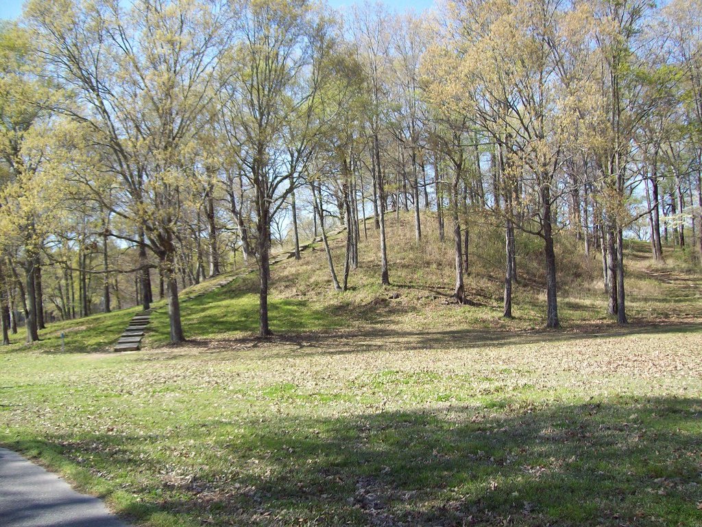
Think about what that speed demands. Not a small band chipping away in spare hours, but thousands of people in one place at one time, fed, housed and coordinated for a season. And then gone. A slow monument you can explain with a resident town. A fast one you cannot, unless the crowd came from somewhere else, did the work, and went home.
The king who was never found
Here the old story runs into trouble. For most of the twentieth century the natural way to explain Poverty Point was to reach for the model that fit every other great monument: a chiefdom. Somebody powerful, the reasoning went, must have lived at the centre, commanded the labour, controlled the trade in exotic stone, and been buried in state when he died. Grand earthworks meant grand rulers. It was less an argument than a reflex.
The trouble is that the ruler has never turned up, and neither has almost anything a permanent capital should leave. Dig at Poverty Point and you do not find the dense rubbish of houses lived in year after year, generation upon generation. You do not find rich graves stuffed with the copper and soapstone that flowed through the place. You do not, in fact, find graves at all, to speak of. For a site this size, occupied on this scale, the near-total absence of burials is loud. A town buries its dead. Poverty Point barely seems to have any.
The old reading: earthworks this vast prove a ranked society: a chief who ruled the region, commanded the workforce, controlled the trade in copper and soapstone, and was buried in splendour at the centre of his capital.
What the ground shows: no royal burials, no rich graves, no dense debris of a long-lived town. “We would expect to see those things if this were a permanent village,” notes the archaeologist Tristram Kidder. The powerful ruler that the monuments seemed to demand has left no trace, because, the newest work argues, he was never there.
In 2025 a team led by Kidder, with Olivia Baumgartel and Seth Grooms, pulled these threads together into a blunt conclusion. The pattern of rapid building, the missing houses, the missing dead, the vast reach of the trade goods: all of it points away from a chiefdom and towards something else. Their estimate for the sheer quantity of earth moved across the whole site runs to the equivalent of roughly a hundred and forty thousand modern dump-truck loads, shifted without a wheel, a draught animal or, they argue, a ruler to crack the whip. “These were egalitarian hunter-gatherers,” as Baumgartel put it, “not subjects to some powerful chiefdom.”
Raise a mountain, then walk away
If no king ordered it, why was it built? The most convincing answer turns Poverty Point from a capital into an event. Picture a place people travelled to, from across the Southeast and the Midwest, at certain times: to trade the stone they had carried, to meet, to marry, to settle debts and stories, and together to build. The mound was not a monument to a person. It was the thing the gathering made. The building was the point.
The timing sharpens it. Poverty Point rose during centuries of a jumpy, violent climate, when the lower Mississippi was prone to sudden and catastrophic flooding. Kidder has spent a career reading those floods in the region's soils, and he reads the great mounds partly as a response to them: an offering, a vast act of collective effort thrown up against a world that kept trying to drown the fields. Not a temple to a god who lived above, exactly, but a sacrifice measured in earth: proof of what a people frightened of the water could do when they pooled their strength.
That reframes the whole site. The rings of posts in the plaza become a stage for ceremony rather than the footings of a palace. The exotic copper and soapstone become the currency of pilgrimage, brought as offerings or traded at the fair, rather than the treasury of a court. And the emptiness that so puzzled the diggers, the lack of houses and graves, stops being a mystery. You do not bury your dead at the fairground. You go home.
Where it still comes apart
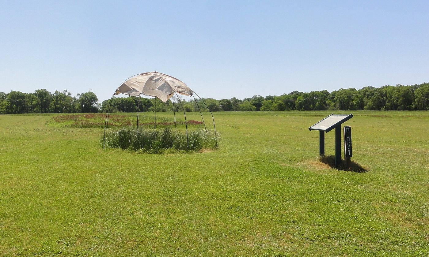
None of this is settled, and it would be dishonest to pretend otherwise. The picture of a periodic gathering place is powerful, but it has a determined and well-informed opponent in the record itself. Jon Gibson, who dug at Poverty Point for more than a decade at the end of the twentieth century, argued the opposite case with real force: that there is simply too much rubbish here, too much of the ordinary residue of daily life, for a spot that people only visited now and then. Somebody, in his reading, lived on those ridges, perhaps camped on the very earthworks as they raised them, perhaps stayed on between the great building seasons.
Was Poverty Point a lived-in community or a place people gathered at and left? Jon Gibson pointed to the sheer volume of everyday debris and argued that a resident population stayed on the ridges. The newer reading (rapid building, no burials, no settled houses) sees a fairground rather than a town, filled for seasons and then emptied. The honest position is that the two pictures still overlap, and the site has not fully surrendered which is right.
Both sides are working from the same ground, and the ground is ambiguous. A place can be visited so often, by so many, that the litter of pilgrimage starts to look like the litter of residence. The difference between a town and a fair held every year for centuries may be thinner than our categories want it to be. What almost everyone now accepts is what once seemed impossible: that whoever they were, and however long they stayed, the builders were not being driven by a chief. They came, it seems, because they chose to.
What the plough nearly took
The name is an accident and a small injustice. Poverty Point was a struggling cotton plantation, and the struggling plantation gave the earthworks a label that reads as failure. For a century and more the ploughs of that farm ran back and forth across the ridges, shaving them down, blurring the arcs, flattening the design a little more with every season, until the shape survived mostly as a whisper in the soil that only a camera in the sky could still hear. In 2014 the site became a UNESCO World Heritage listing, the first in Louisiana, which is a strange fate for ground once thought worthless.
Stand in the plaza now and you still cannot see the thing you are standing in. The arcs are too low and too wide for a human eye at ground level; they were, in a sense, never meant to be seen whole by the people who made them, only walked and lived and worked upon. It took an aeroplane, thirty centuries later, to lift the drawing off the earth and hold it up to the light. The people who dug it moved a hundred and forty thousand truckloads of soil with baskets and bare backs, left behind cooking clay and foreign copper and no name we will ever know, and raised, for reasons we are still arguing over, one of the largest things anyone built in the ancient Americas. And then, when the last basket was tipped, they walked home.
Read next: Trypillia: The 6,000-Year-Old Cities That Burned Themselves Down.
Sources & further reading
- Ortmann, A. L. & Kidder, T. R. — ‘Building Mound A at Poverty Point, Louisiana: monumental public architecture, ritual practice, and implications for hunter-gatherer complexity’, Geoarchaeology (2013).
- Kidder, T. R., Baumgartel, O. & Grooms, S. — 2025 study reinterpreting Poverty Point as an egalitarian gathering place; reported by WashU (The Source), Archaeology magazine and phys.org, October–November 2025.
- Gibson, J. L. — The Ancient Mounds of Poverty Point: Place of Rings (University Press of Florida, 2000).
- Spivey, S. M. & others — research on Poverty Point Objects and earth-oven cooking, Louisiana State University.
- UNESCO World Heritage Centre — ‘Monumental Earthworks of Poverty Point’ inscription file (2014).
Image credits (via Wikimedia Commons): aerial reconstruction of Poverty Point — Herb Roe (CC BY-SA 4.0); Mound A — Kniemla (CC BY-SA 2.0); site plan — Maximilian Dörrbecker / Chumwa (CC BY-SA 2.5); Poverty Point Objects — Uyvsdi (CC BY-SA 3.0); reconstructed hut on Ridge 1 — Bart Everson (CC BY 2.0).