The Bedouin who led Bertram Thomas across the southern sands in the winter of 1930 had a name for a place none of them had ever seen. They called it the road to Ubar, and they pointed north across the dunes towards nothing at all: open desert, the blank middle of the map. A city had stood out there once, the old men said. It had grown rich beyond counting on a trade in perfumed smoke, and then it had grown proud, and God had let the sand swallow it in a single night. Thomas noted the bearing and rode on. To him it was a curiosity. To the men who came after him it became an obsession that would take sixty years, a Hollywood budget and a spacecraft to settle.
The name people fixed on was Ubar. Sometimes it was Iram, or Wabar, or the city of the pillars. The details changed with the teller, but the shape of the story held: somewhere in the Rub’ al Khali, the Empty Quarter of Arabia, there was a lost place, and if you could only find the right dune it would still be there, its towers half-buried, its wealth waiting. For a very long time nobody could. The desert is the size of France and moves in its sleep. A city could hide in it forever.
The city that was only a story
The oldest version of the tale is not Bedouin at all. It sits in the Qur’an, in the chapter called The Dawn, which speaks of Iram of the pillars, “the like of which had never been built in any land.” Iram belonged to a people called ‘Ad, who were tall and mighty and sure of themselves, and who ignored the warnings of the prophet Hud. For their arrogance a wind was sent against them, howling for seven nights, until the whole people were left lying like the hollow trunks of fallen palms. The city vanished with them.
Stories like that travel well, and this one picked up gold as it went. By the time medieval Arab geographers were writing it down, Iram had become a paradise of columns and gardens built by a king named Shaddad, paved with jewels, hidden by God so that no proud man could gloat over its ruins. A wanderer might stumble on it once in a lifetime, carry off a handful of pearls, and never find the gate again. It was the sort of place that exists only in the distance, always one more valley away.
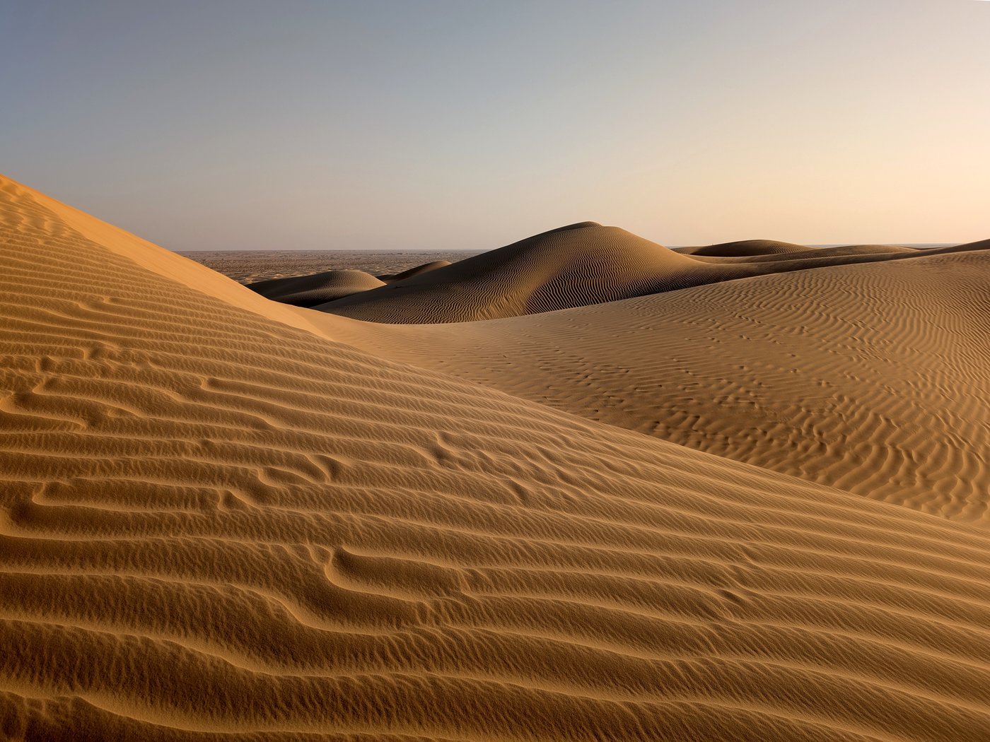
The West got hold of the legend late and loved it at once. T. E. Lawrence, of Arabia, called Ubar “the Atlantis of the sands” and wanted to fly out and look for it from the air. He died in a motorcycle crash before he could. The phrase stuck, and it did the legend no favours. Atlantis is a byword for something that probably never existed. Attaching the name to Ubar filed it under fantasy, alongside sea-kings and sunken continents, and there it sat for most of a century.
The men who went looking
Not everyone was willing to leave it there. Bertram Thomas, the first European known to have crossed the Empty Quarter, took the Bedouin road-to-Ubar seriously enough to write it down. So did Harry St John Philby, an explorer and convert to Islam who set out in 1932 determined to find the ruined city and beat Thomas to a real discovery. Philby crossed weeks of the worst desert on earth to reach the spot the tribes told him held the remains of Wabar. What he found was not a city. It was a field of blackened craters and lumps of fused sand, which he took for the slag of some vast furnace.
He was closer to a real marvel than he knew. The Wabar craters are impact scars, gouged out by a meteorite that hit the sand hard enough to melt it into glass. To the tribes who knew them, they were the burnt bones of the sinful city, struck down by fire from heaven. Two different legends, two different places, one shared name, and neither of them the pillared paradise anyone was hoping for. Philby went home disappointed. Wilfred Thesiger crossed the same sands a decade later, wrote one of the great books of desert travel, and mentioned Ubar only as a name the Bedouin used, a rumour attached to a route.
The man who finally cracked it was not an explorer or an archaeologist. Nicholas Clapp made documentary films for a living, and he read Thesiger’s Arabian Sands the way other people catch a fever. He could not let the city go. He had no money for camels and guides and years in the field. What he had, living in California in the 1980s, was access to something none of the old searchers ever dreamed of: a laboratory that could look at the desert from space.
A map made of camel tracks
Clapp talked his way into NASA’s Jet Propulsion Laboratory and put his case to the scientists there. If a city had traded across this desert for centuries, he argued, the caravans would have worn roads into the ground. Thousands of camels, year after year, following the water from well to well. Roads like that do not simply blow away. They compact the soil, change how it holds moisture, leave a signature the eye cannot see but an instrument might.
The researchers, chiefly a geologist named Ron Blom, went to work with the imagery they had: Landsat pictures, French SPOT photographs, and radar data gathered by an antenna flown on the Space Shuttle. Radar was the key. Its long wavelengths react to the roughness and buried structure of the ground, not just its colour, and in very dry sand it can hint at what lies a little beneath the surface. Blom’s team combined the data, sharpened it, and started tracing faint pale lines across the Dhofar region of Oman: old tracks, converging like the spokes of a wheel on a single point.
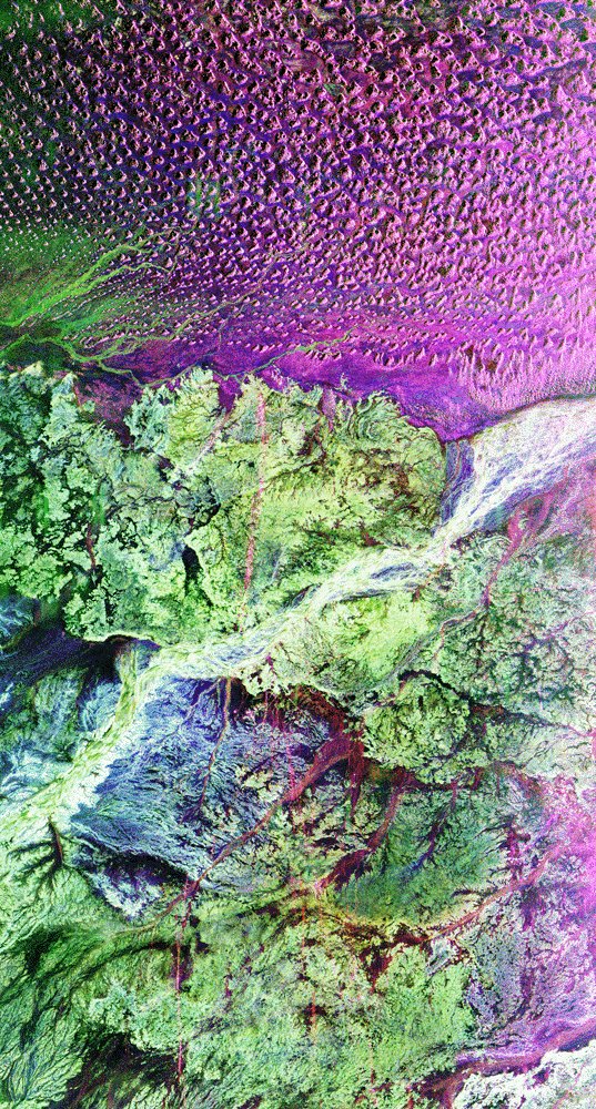
It is worth being honest about what the satellites did and did not do. They did not photograph a buried city, and no instrument saw towers under the sand. What the combined imagery showed was the pattern of the roads: a web of long-used tracks pointing at one place. That was enough. The tracks led to a spot the maps of the region already carried a name for: Ash Shisr, a well in the gravel desert north of the frankincense hills, where there had been a spring and, at some point, something built around it. The satellites had not found a legend. They had drawn an arrow at a dot on the ground and said: dig here.
The well at Shisr
Digging began in 1991 under Juris Zarins, an archaeologist who had spent his career in Arabia and who was, from the start, wary of the word “lost city.” The expedition had the flavour of an adventure film (Clapp with his cameras, the lawyer George Hedges who had helped raise the money, the explorer Ranulph Fiennes lending his fame), but the trenches told a sober, particular story.
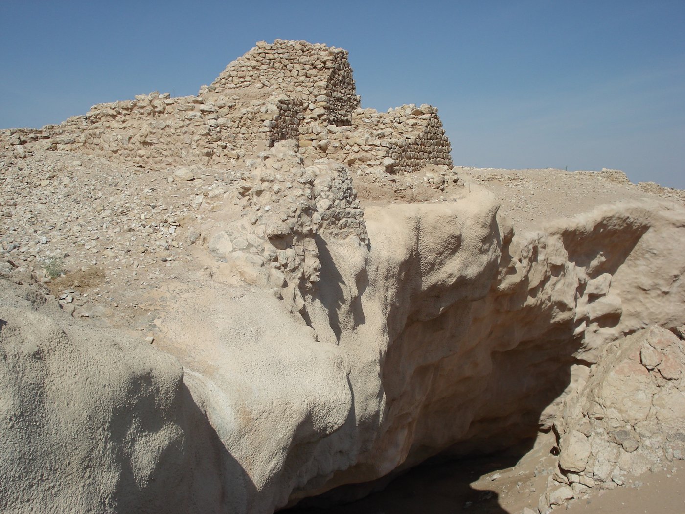
Under the modern surface at Shisr lay the walls of a fortress. It was roughly octagonal, with tall walls and towers at the corners, built and rebuilt in stone and mud brick around a precious spring. This was no jewelled metropolis. It was a stronghold, the kind of place that guards a water source and the goods passing through it. But the ordinary rubbish of the site was anything but ordinary. Mixed into the sand were pieces of pottery and glass from Greece and Rome, from Syria and Mesopotamia, and fragments that had come the whole way from China. For a huddle of towers in the middle of the harshest desert on earth, Shisr had been startlingly well connected.
Frankincense was not a luxury at the edges of the ancient economy; it was near the centre of it. Pliny the Elder, writing in the first century, complained that the trade drained Rome of a fortune every year, and grumbled his way along the incense road listing the tolls charged at every stop: to priests, to scribes, to gate-keepers, to soldiers, to the king. Rome burned the resin by the ton at funerals and altars. The emperor Nero is said to have burned a year’s harvest of Arabia in a single day at the funeral of his wife. A desert fort that controlled where that resin was gathered controlled real money.
Why anyone built a fort in the middle of nowhere
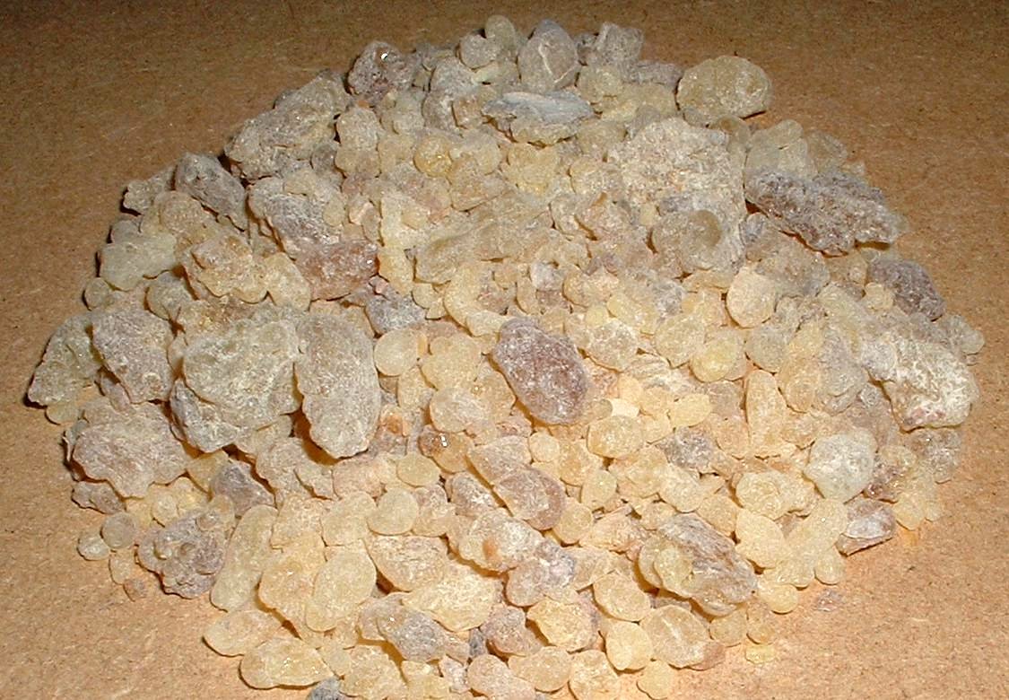
To understand Shisr you have to look south, to the hills above the coast, where an unremarkable, twisted little tree grows out of the rock. Boswellia sacra does not look like the source of an empire’s wealth. It is scrubby and grey and clings to dry slopes that grow almost nothing else. Cut its bark, though, and it weeps a pale gum that hardens in the air into brittle, honey-coloured lumps. Burn those lumps and they give off the clean, resinous smoke that the ancient world could not get enough of. This is frankincense, and the best of it in all the world came from Dhofar.
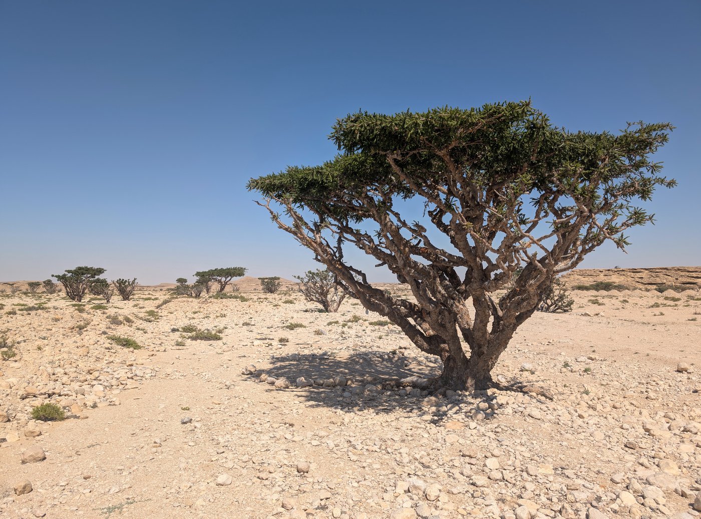
The harvest was slow and skilled work. Tappers scored the trunk, waited for the wound to bleed and dry, then scraped off the hardened resin (the “tears”) and scored the tree again. The finest grades were pale and clean. A single tree gave only so much a season, and the groves grew in a narrow band of country that happened to sit at the far end of a very long, very thirsty road. Whoever gathered the tears still had to get them across the desert to the buyers in the north. That is where a well in the gravel plains earned its keep.
The tears of Dhofar
The resin left the hills on the backs of camels. Caravans carried it inland to collection points like Shisr, where there was water and safety, and from there north across Arabia along the incense road towards Petra, Gaza and the markets of the Mediterranean. Some of it went by sea, out of the port of Khor Rori on the Dhofar coast, where a fortified town called Sumhuram loaded frankincense for the ships that rode the monsoon to India and back. The trade ran for well over a thousand years, and the towns that grew up along it (the groves at Wadi Dawkah, the port at Khor Rori, the caravan halt at Shisr) are today gathered together on the UNESCO World Heritage list as the Land of Frankincense.
Seen this way, the fort stops being a riddle. Nobody built a stronghold in the deep desert for the view. They built it because a spring in that particular patch of nowhere let the caravans cross, and because whoever held the spring held a hand on the trade. Shisr was not the destination. It was a valve on a pipeline, and the pipeline carried something close to liquid gold.
The night the ground gave way
The strangest discovery at Shisr was not a wall or a jar. It was a hole. The fort had been built on top of a large limestone cavern, hollowed out over ages by the same underground water that fed the spring. For as long as the cavern stayed full, it held the weight above it. But the water table dropped (slowly, over generations, perhaps hurried along by the very people drawing on it), and the roof of the cave, no longer supported from below, gave way. The ground opened, and a good part of the settlement, walls and towers and all, slid down into the pit it had been standing on.
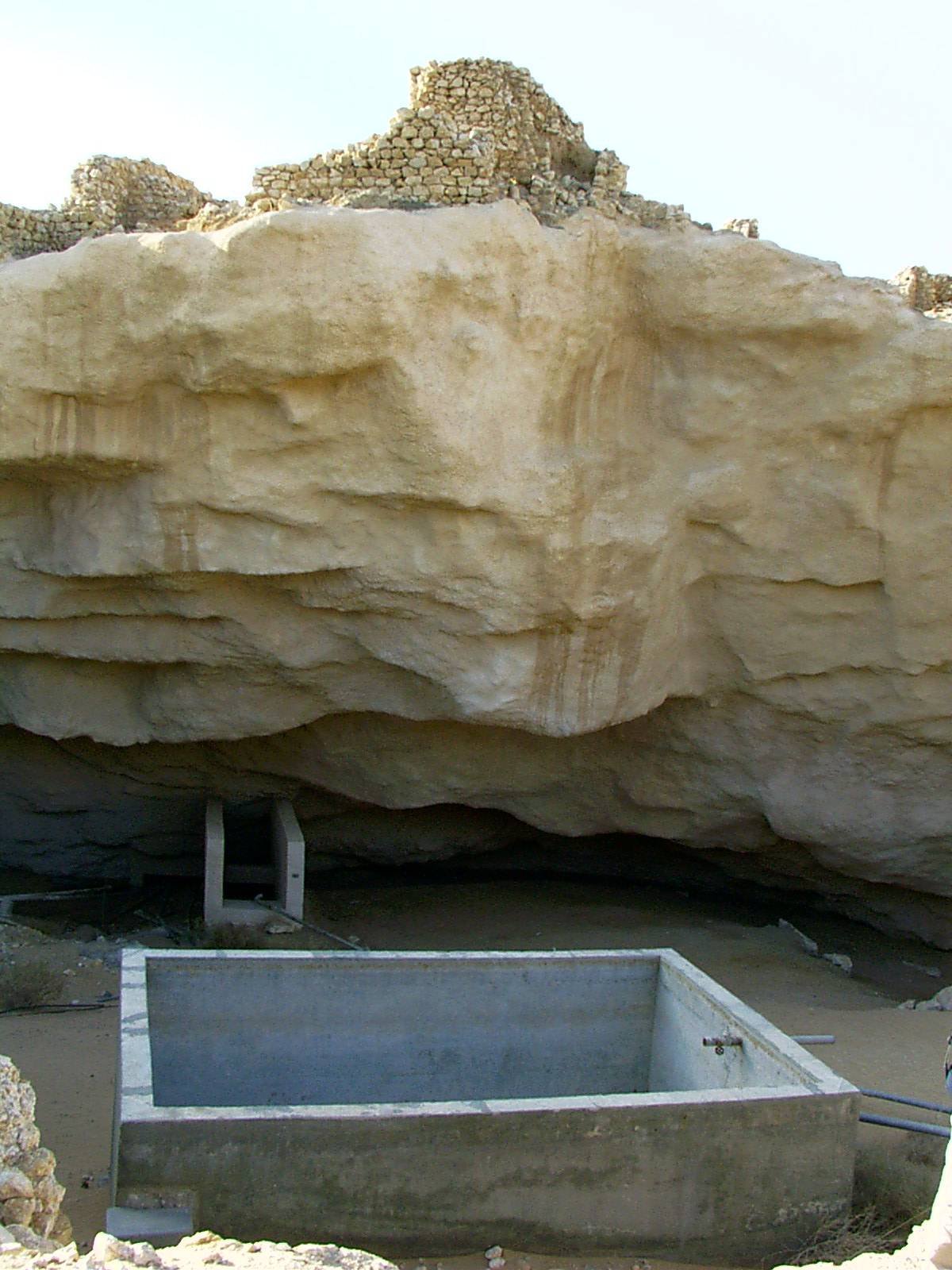
Read that against the old story and the hair on your arms stands up. A proud city, standing over an emptiness it could not see, brought down into the earth in a rush. The legend said God swallowed the city in a night for its arrogance. The geology says a cavern that people had been draining for water finally failed and pulled the buildings down. Those are not the same explanation. But they are plainly the same event, told twice: once by an engineer and once by a preacher.
In the legend Ubar is a fabulous city of columns and gardens, obscenely rich, wiped from the earth in one stroke of divine anger and buried so deep that no proud eye would ever find it again.
What the trenches held was a modest desert fort of walls and towers around a spring, its wealth borrowed from the caravans passing through rather than piled up in its own streets. And it was not destroyed in a night. The collapse of the cavern beneath it was a slow, natural failure of overdrawn ground: real, dramatic, and nothing to do with gardens or pillars. The legend did not invent the disaster. It compressed it, moralised it, and gave it a better ending.
Whose city was it, anyway?
When the news broke in 1992 the headlines wrote themselves. “Lost city of Ubar found.” “Atlantis of the sands rises from the desert.” It was a wonderful story and, in its enthusiasm, it ran well ahead of the evidence. The man who had done the digging was the one most anxious to slow it down.
Juris Zarins has argued, patiently and often, that the whole framing is off. There may never have been a single lost city called Ubar at all. In the old sources, he points out, Ubar (or Iram, or the land of ‘Ad) often reads less like a town and more like a region and the people who lived in it, a whole frankincense country rather than one address. The site at Shisr is a real, important caravan fort, one node in that network. Calling it “the lost city of Ubar” makes it carry a weight of legend it was never built to bear.
One camp is happy to say the searchers found what they were looking for: the tracks led to Shisr, Shisr sat at the heart of the frankincense trade, and Shisr collapsed into the ground, near enough to the legend to earn the name. The other camp, Zarins among them, warns that “Ubar” may always have meant a people and their territory rather than a single settlement, and that dressing one fort up as a fabled metropolis tells the public a tidier story than the ground supports. Both sides agree on the stones in the trench. They disagree about which word to write on the sign.
A rumour with a real address
What the expedition really proved is subtler, and in some ways better, than a city of gold. It showed that the Bedouin were not making things up. There was a place. There was a road. There was wealth crossing the sand, and there was a fort standing over a hole that would one day open and take it down. The legend had exaggerated all of it and explained none of it correctly, and it had still been pointing, all along, at somewhere true.
Most of Shisr is still in the ground. The Empty Quarter has given up an arrow and a well and the outline of a stronghold, and kept the rest to itself: the caravans that never arrived, the tappers and drivers and toll-takers whose names no text preserves, the exact year the roof came down. Lawrence wanted his Atlantis of the sands. He got, in the end, something less romantic and harder to dismiss: not a drowned paradise, but the plain wreck of a place that really lived on smoke, and really fell into the earth, and turned into a story because the truth was almost strange enough on its own.
Read next: Qaryat al-Faw: The Three-Storey Market on the Empty Quarter's Edge.
Sources & further reading
- Nicholas Clapp, The Road to Ubar: Finding the Atlantis of the Sands (Houghton Mifflin, 1998).
- Juris Zarins, The Land of Incense: Archaeological Work in the Governorate of Dhofar, Sultanate of Oman, 1990–1995 (Sultan Qaboos University, 2001).
- NASA Jet Propulsion Laboratory, “Space Radar Image of Ubar” and related releases on the SIR-C/X-SAR imaging of southern Oman.
- Pliny the Elder, Natural History, Book XII, on frankincense and the incense trade.
- UNESCO World Heritage Centre, “Land of Frankincense” (inscribed 2000), covering Shisr, Khor Rori, Al-Baleed and Wadi Dawkah.
- Wilfred Thesiger, Arabian Sands (Longmans, 1959), for the desert and the Bedouin memory of the road to Ubar.
Image credits (via Wikimedia Commons): the ruins of Ubar / Shisr (featured) — 9591353082 (Wikipedia) (CC BY 2.5); Space Shuttle radar image of Ubar — NASA/JPL (Public domain); frankincense tree, Boswellia sacra — Krzysztof Ziarnek (Kenraiz) (CC BY-SA 4.0); frankincense resin from Dhofar — Gaius Cornelius (Public domain); the collapsed sinkhole at Shisr — Bz-mof (Public domain); the Rub' al Khali / Empty Quarter — Krzysztof Ziarnek (Kenraiz) (CC BY-SA 4.0).